©Visit Luxembourg
Müllerthal Germany France

Ierelchen Echternach - Hiking trail - Accessible to almost all

Starting point

Parking Place Mélick

Destination

Parking Place Mélick

Distance
3,32 km
Difficulty
easy
  • Condition
Highest point
338 Hm
Lowest point
292 Hm
Aggregated Ascent
60 Hm
Aggregated Descent
57 Hm
Thematic paths Visit Luxembourg

Description

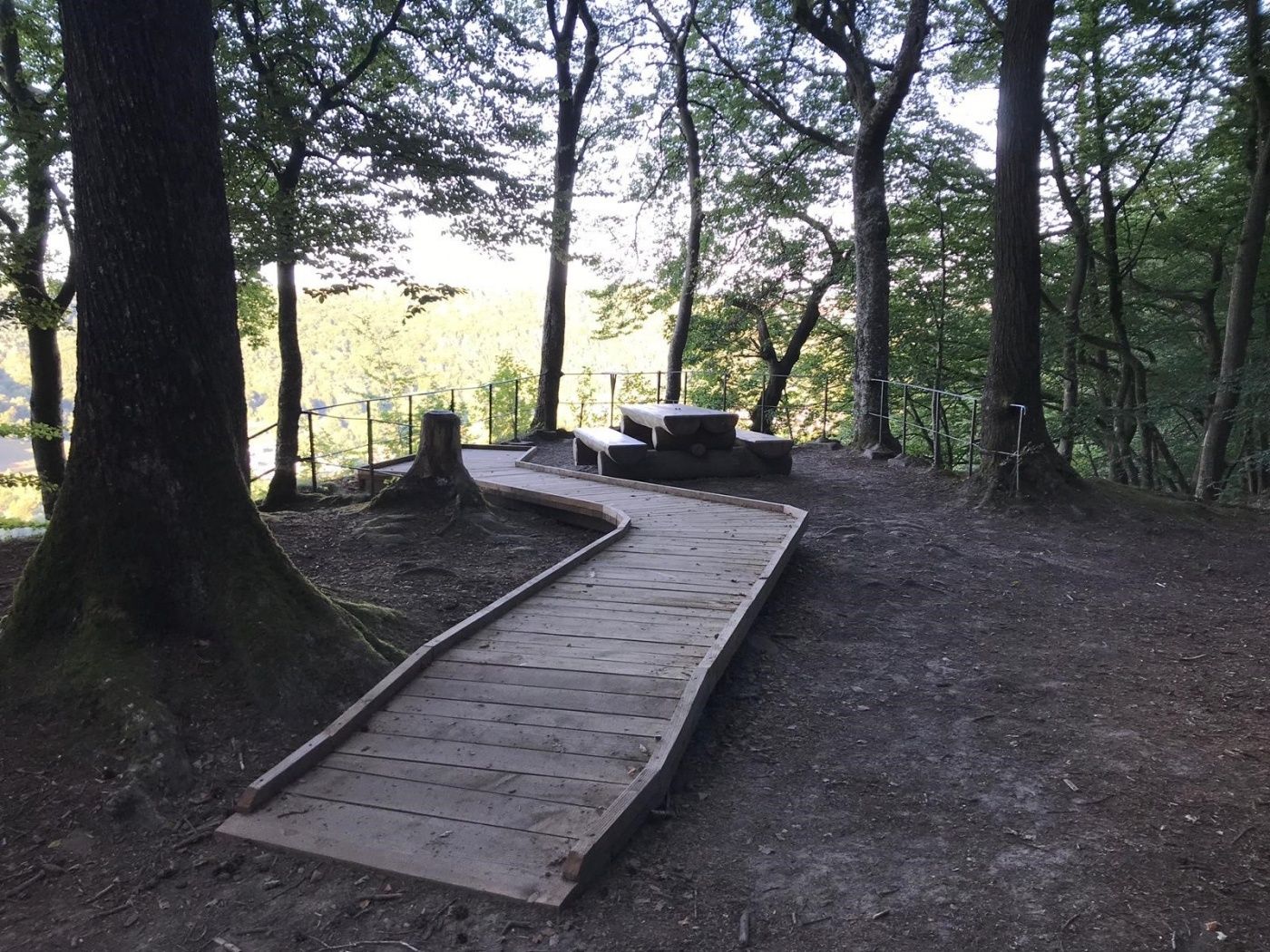
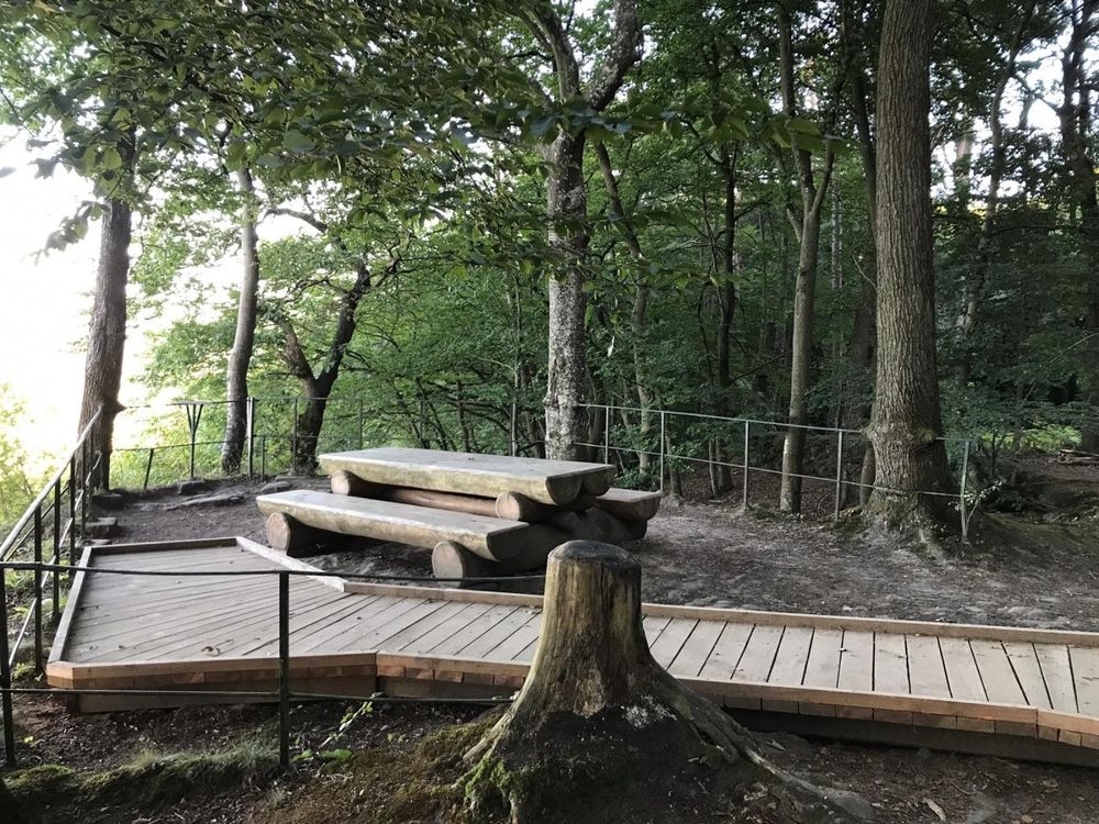
Trail on a flat pathway through the forest with a nice picnic spot.

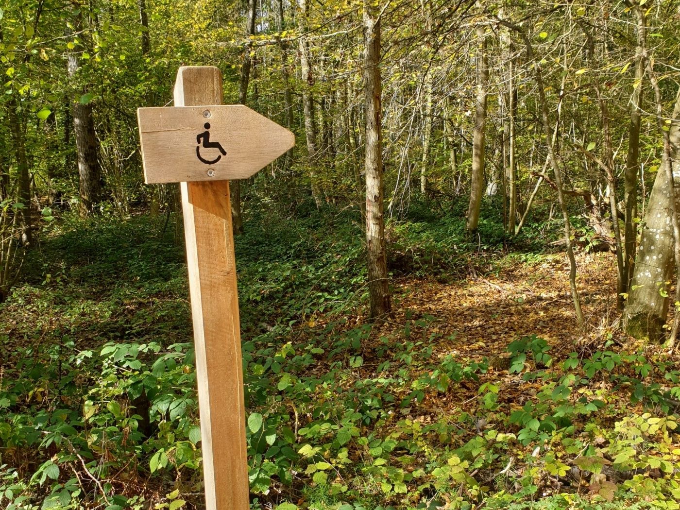
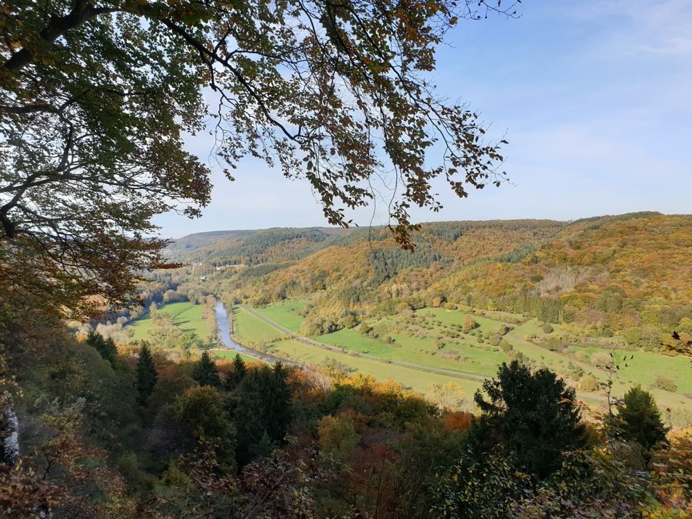
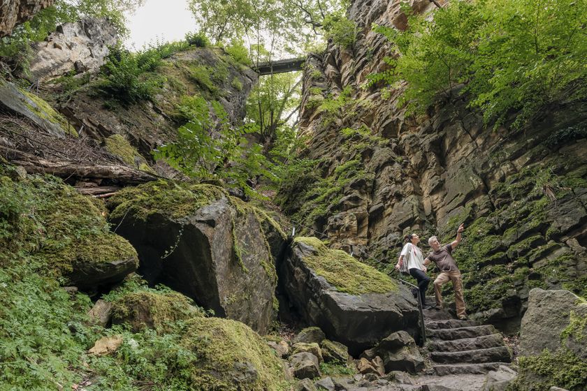
The communal forest of Echternach is called “Ierelchen” and is situated Op Mélick. There is a forest path accessible to all without a major incline. From the trail it is about 50 m to the Paulsplatte, which is marked by a wheelchair pictogram. A ramp accessible to all leads to a lookout point of view on the Sûre valley.

Suggestions nearby

Ierelchen Echternach - Hiking trail - Accessible to almost all

  • ©Pancake! Photographie
    Rock formation "Wollefsschlucht"
    Imposing rock gorge with rock walls rising up to 50 m in height.
    Find out more

Similar hiking tours

©Ville de Dudelange, Ville de Dudelange
Circular routes
Local hiking trail Dudelange - "Buerfousswee"
Distance: 0,64 km
Duration: 0:10 h
Difficulty: easy
Find out more
©Administration des Eaux et Forêts / LFT
Local hiking trail Esch: Sentier Pierre Wies trail – 8.5km
Distance: 10,60 km
Duration: 2:55 h
Difficulty: easy
Find out more
©KuFa
Circular routes
Nature walk Natura 2000 - Boucle C: "La succession végétale sur un ancien territoire minier" – 2,5 km
Distance: 2,68 km
Duration: 0:45 h
Difficulty: easy
Find out more
©Pulsa Pictures, Pulsa Pictures ORT Sud
Local hiking trail Esch: Réimerwee - 4 km
Distance: 4,42 km
Duration: 1:15 h
Difficulty: easy
Find out more
©Visit Luxembourg
Circular routes
Auto-Pédestre trail Büderscheid
Distance: 4,64 km
Duration: 1:20 h
Difficulty: easy
Find out more
©Fränk Weber, Studio Frank Weber
Circular routes
Auto-Pédestre Bourscheid route
Distance: 5,88 km
Duration: 2:00 h
Difficulty: easy
Find out more
©ORT Sud
Circular routes
Local hiking route "Parc Le'h" - children’s route
Distance: 1,46 km
Duration: 0:25 h
Difficulty: easy
Find out more
©Visit Luxembourg
Circular routes
Auto-Pédestre Hiking Route Eschweiler
Distance: 7,05 km
Duration: 1:55 h
Difficulty: easy
Find out more
©Visit Luxembourg
Circular routes
Auto-Pédestre trail Surré
Distance: 6,21 km
Duration: 1:45 h
Difficulty: easy
Find out more
outdooractive This website uses technology and content from the Outdooractive Platform.