©Fränk Weber, Studio Frank Weber
Éislek Germany France

Auto-Pédestre Bourscheid route

Starting point

34 Groussgaass, Bourscheid

Destination

34 Groussgaass, Bourscheid

Distance
5,88 km
Duration
2:00 h
Difficulty
easy
  • Condition
Highest point
496 Hm
Lowest point
307 Hm
Aggregated Ascent
180 Hm
Aggregated Descent
180 Hm
Circular routes Visit Luxembourg

Description

Scenic Refreshment stops available

The Auto-Pédestre Bourscheid route runs through wild landscapes and offers great views of the famous castle.

Starting from the village center, the Auto-Pédestre Bourscheid crosses the CR 348 and then leads into the dense forest north of the village. The path descends all the way to the Féischterhaff. This somewhat remote farm is located in a meander of the Sauer.

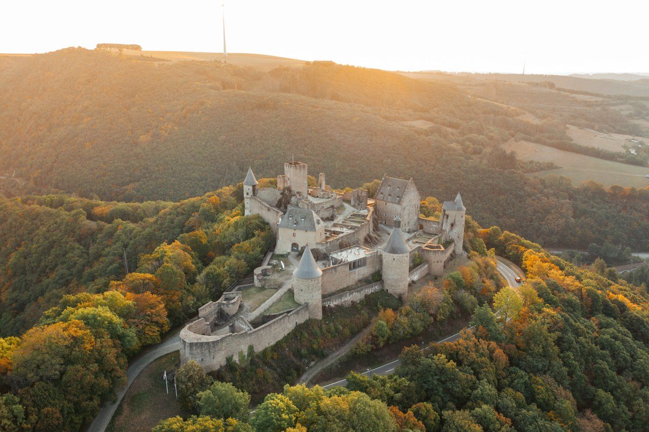
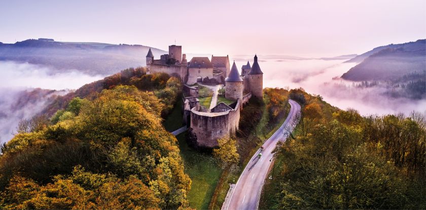
The path now runs southwards, gently uphill to the 10th-century Bourscheid Castle. This triangular castle towers about 150 meters above the Sauer and is accessible only from one side, which deters enemies. Over time, the property developed from a small wooden fort into the impressive feudal castle we know today. Since 1972, it has been state-owned and has undergone constant renovation work.

The hike continues eastward. You quickly reach the viewpoint at the Schleedbësch, which offers a wonderful panorama of the castle.

After climbing a few hundred meters uphill, the end of the hike comes into sight.

Suggestions nearby

Auto-Pédestre Bourscheid route

  • ©Studio Frank Weber
    free
    with theLuxembourgPass
    Bourscheid Castle
    Explore the fascinating Bourscheid Castle, where history meets breathtaking natural scenery. The imposing castle towers majestically over the Sûre valley and invites you to travel back in time to a bygone era. An unforgettable excursion the rich history of Éislek.
    Find out more

Similar hiking tours

©Ville de Dudelange, Ville de Dudelange
Circular routes
Local hiking trail Dudelange - "Buerfousswee"
Distance: 0,64 km
Duration: 0:10 h
Difficulty: easy
Find out more
©ORT Sud
Circular routes
Natura 2000 nature trail - Loop B: “The exploitation of iron ore lands, past and present” – 4.5 km
Distance: 4,88 km
Duration: 1:15 h
Difficulty: easy
Find out more
©ORT SUD
Circular routes
Local hiking trail Esch: Sentier Norbert Theis Trail – 7km
Distance: 7,98 km
Duration: 2:15 h
Difficulty: easy
Find out more
©Visit Luxembourg
Circular routes
Auto-Pédestre trail Büderscheid
Distance: 4,64 km
Duration: 1:20 h
Difficulty: easy
Find out more
©Visit Luxembourg
Circular routes
Auto-Pédestre trail Bürden
Distance: 4,62 km
Duration: 1:25 h
Difficulty: easy
Find out more
©ORT Sud
Circular routes
Local hiking route "Parc Le'h" - children’s route
Distance: 1,46 km
Duration: 0:25 h
Difficulty: easy
Find out more
©Visit Luxembourg
Circular routes
Auto-Pédestre Hiking Route Eschweiler
Distance: 7,05 km
Duration: 1:55 h
Difficulty: easy
Find out more
©Visit Luxembourg
Circular routes
Auto-Pédestre trail Surré
Distance: 6,21 km
Duration: 1:45 h
Difficulty: easy
Find out more
©Phothoteque de la Ville de Luxembourg - Tony Krier, Unknown
Shoah Memorial Trail in Luxembourg City
Distance: 3,26 km
Duration: 1:54 h
Difficulty: easy
Find out more
outdooractive This website uses technology and content from the Outdooractive Platform.