©SIAS, SIAS
Mosel Germany France

Pollinators in the vineyard

Hunting Season 2026/27 — Check for hunts

Autumn is here, and that means hunting season has begun! From mid-October to January/February, hunters are active across the country. Stay safe by checking hunt dates in your area on our Map. 

Click on Map in the Header > Services > More > Hunting.

Starting point

49.506959, 6.341209

Destination

49.506959, 6.341209

Distance
1,53 km
Difficulty
easy
  • Condition
Highest point
225 Hm
Lowest point
174 Hm
Aggregated Ascent
53 Hm
Aggregated Descent
53 Hm
Thematic paths Visit Luxembourg

Description

Scenic
Pollinators in the vineyard

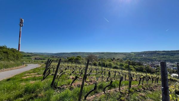
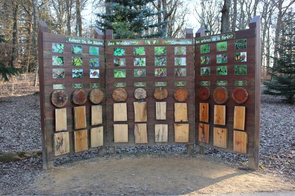
The themed trail "Pollinators in the Vineyard" on the Wintringer Hommelsberg features seven information panels along a 1.5 km route, providing fascinating insights into the various measures implemented to support wild bees and other insect species. Topics include organic viticulture, dry stone walls, roses in the vineyard, fruit trees and viticulture, biodiversity towers, the vineyard's microclimate, as well as ground cover and grazing.

Suggestions nearby

Pollinators in the vineyard

  • ©Bistro Gourmand
    Restaurant Le Bistrot Gourmand
    Restaurant Le Bistrot Gourmand
    Find out more

  • No image available
    Nature reserve "Kuebendällchen"
    Nature reserve "Kuebendällchen"
    Find out more
  • ©Domaine Sunnen-Hoffmann
    Domaine Sunnen-Hoffmann
    Domaine Sunnen-Hoffmann
    Find out more

Similar hiking tours

©Visit Luxembourg
Circular routes
Local hiking trail GM4 - Pärdsmaart
Distance: 4,62 km
Duration: 1:30 h
Difficulty: easy
Find out more
©Administration des Eaux et Forêts / LFT
Local hiking trail Esch: Sentier Pierre Wies trail – 8.5km
Distance: 10,60 km
Duration: 2:55 h
Difficulty: easy
Find out more
©ORT Sud
Circular routes
Natura 2000 nature trail - Loop B: “The exploitation of iron ore lands, past and present” – 4.5 km
Distance: 4,88 km
Duration: 1:15 h
Difficulty: easy
Find out more
©Pulsa Pictures, Pulsa Pictures ORT Sud
Local hiking trail Esch: Réimerwee - 4 km
Distance: 4,42 km
Duration: 1:15 h
Difficulty: easy
Find out more
©Visit Luxembourg
Circular routes
Auto-Pédestre Hiking Trail Büderscheid
Distance: 4,64 km
Duration: 1:20 h
Difficulty: easy
Find out more
©Luxembourg for Tourism
Circular routes
Auto-Pédestre Bourscheid route
Distance: 5,88 km
Duration: 2:05 h
Difficulty: easy
Find out more
©ORT Sud
Circular routes
Local hiking route "Parc Le'h" - children’s route
Distance: 1,46 km
Duration: 0:25 h
Difficulty: easy
Find out more
©Visit Luxembourg
Circular routes
Auto-Pédestre Hiking Route Eschweiler
Distance: 7,05 km
Duration: 1:55 h
Difficulty: easy
Find out more
©Visit Luxembourg
Circular routes
Auto-Pédestre Hiking Trail Surré
Distance: 6,21 km
Duration: 1:45 h
Difficulty: easy
Find out more
outdooractive This website uses technology and content from the Outdooractive Platform.