©L. Schömer, Visit Luxembourg
Müllerthal Germany France

Local hiking trail - J16

Hunting Season 2025/26 — Check for hunts

Autumn is here, and that means hunting season has begun! From mid-October to January/February, hunters are active across the country. Stay safe by checking hunt dates in your area on our Map. 

Click on Map in the Header > Services > More > Hunting.

Starting point

Godbrange: Pavilion at the church

Destination

Godbrange: Pavilion at the church

Distance
5,60 km
Duration
1:25 h
Difficulty
easy
  • Condition
Highest point
410 Hm
Lowest point
322 Hm
Aggregated Ascent
93 Hm
Aggregated Descent
93 Hm
Circular routes Visit Luxembourg

Description

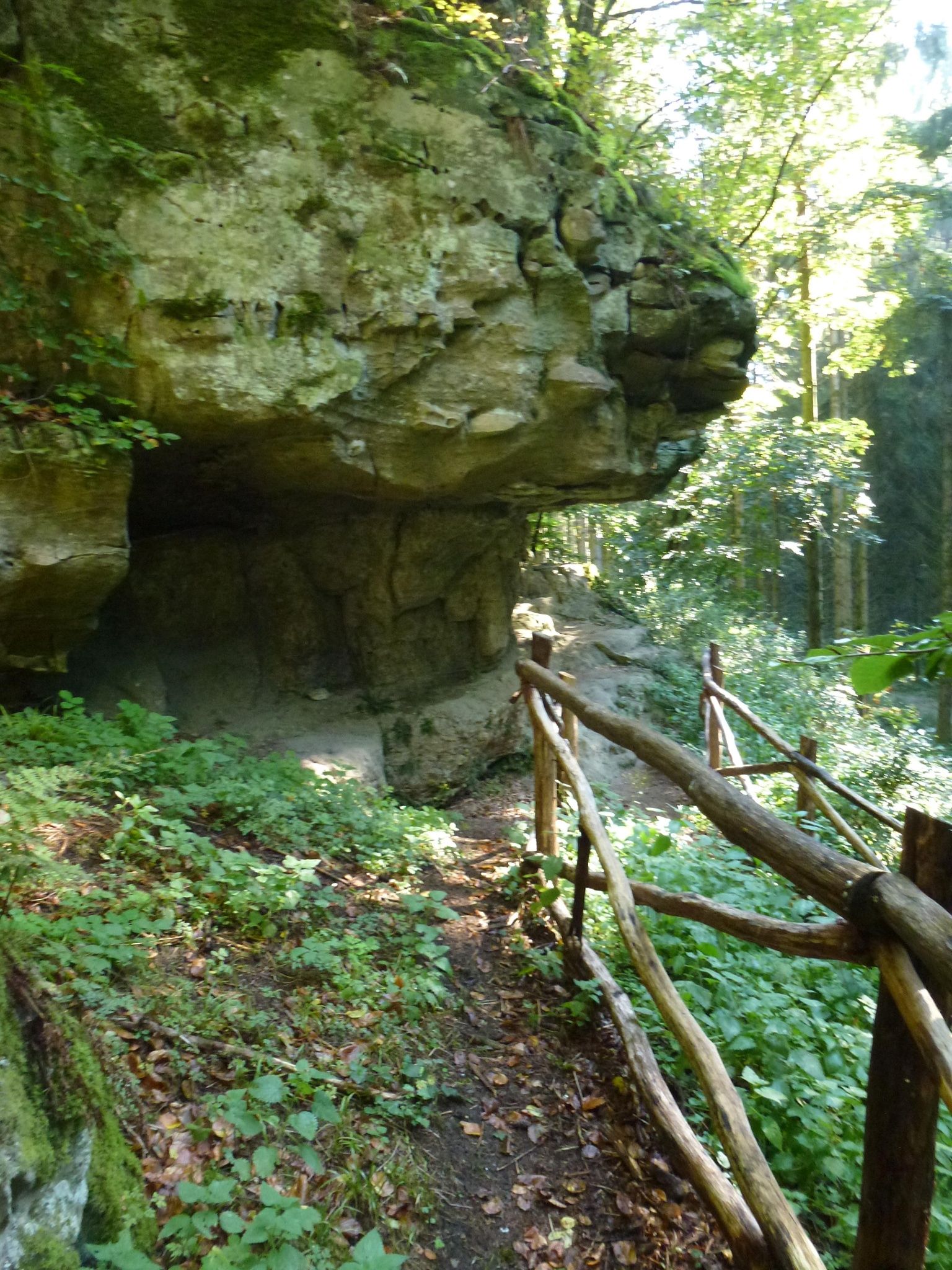
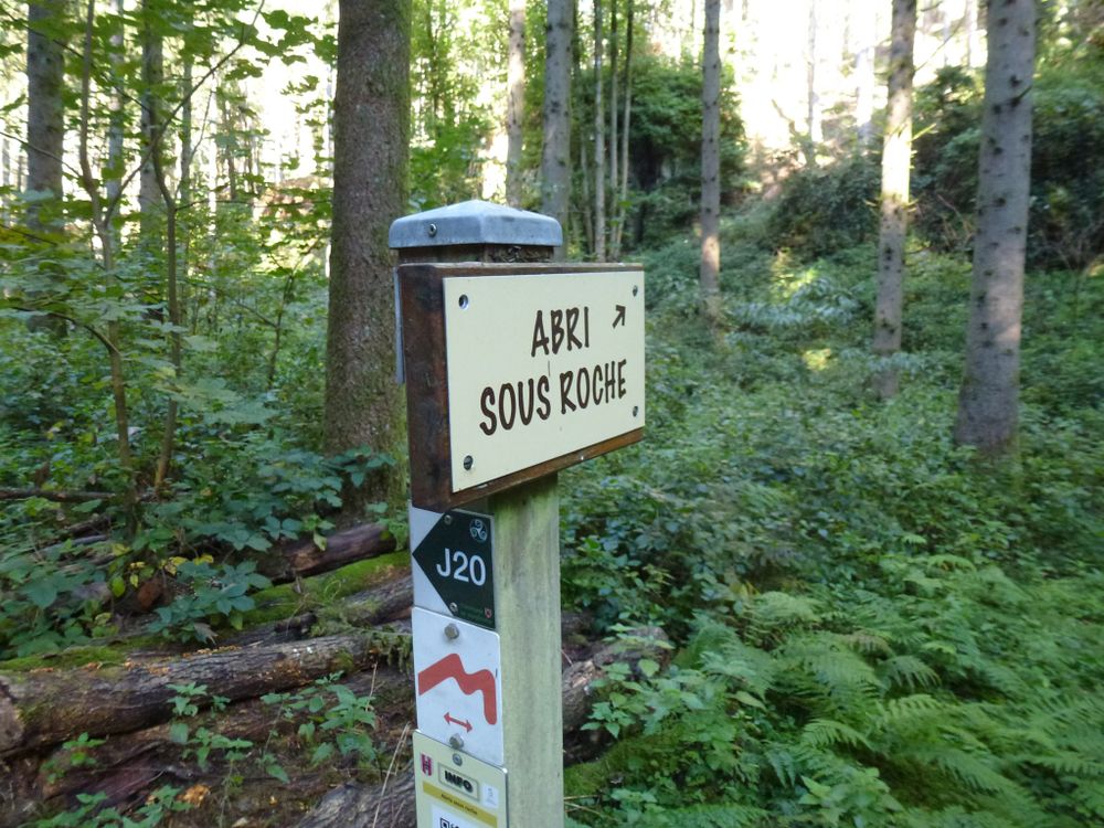
The highlights of the tour are a Stone Age dwelling "abris sous roche" and a romantic pond in the forest with a place to rest.

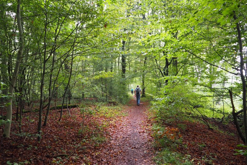
The Schwäibësch hiking trail starts in Godbrange and then takes you via the village of Schilzbierg, up the Houbierg hill and then down to the Schwäibësch forest.

This rustic, quiet forest probably got its name a long time ago from its strong wild boar population.

You will come across an overhanging rock, of which you see so many in the region. Stone Age people used these natural rocky outcrops as dwellings.

A romantic forest pond in Schwäubësch invites you to have a rest. You then go through the meadows of Lambert back to your starting point in Godbrange.

Similar hiking tours

©Administration des Eaux et Forêts / LFT
Local hiking trail Esch: Sentier Pierre Wies trail – 8.5km
Distance: 10,60 km
Duration: 2:55 h
Difficulty: easy
Find out more
©Pancake!
Circular routes
Nature walk Natura 2000 - Boucle A: « L’homme et la forêt » – 5 km
Distance: 5,51 km
Duration: 1:30 h
Difficulty: easy
Find out more
©ORT Sud
Circular routes
Natura 2000 nature trail - Loop B: “The exploitation of iron ore lands, past and present” – 4.5 km
Distance: 4,88 km
Duration: 1:15 h
Difficulty: easy
Find out more
©Visit Luxembourg
Circular routes
Auto-Pédestre trail Bürden
Distance: 4,62 km
Duration: 1:25 h
Difficulty: easy
Find out more
©ORT Sud
Circular routes
Local hiking route "Parc Le'h" - children’s route
Distance: 1,46 km
Duration: 0:25 h
Difficulty: easy
Find out more
©Phothoteque de la Ville de Luxembourg - Tony Krier, Unknown
Shoah Memorial Trail in Luxembourg City
Distance: 3,26 km
Duration: 1:54 h
Difficulty: easy
Find out more
©Visit Luxembourg
Thematic paths
Honeybee educational trail between Waldbillig and Christnach
Distance: 4,00 km
Duration: 1:30 h
Difficulty: easy
Find out more
©ORT Sud
Thematic paths
Educational trail “Felten's Pol säi Léierpad"
Distance: 1,80 km
Duration: 0:25 h
Difficulty: easy
Find out more
©Visit Luxembourg
Circular walk "Historical Trail Loop Ehnen"
Distance: 1,03 km
Duration: 0:17 h
Difficulty: easy
Find out more
outdooractive This website uses technology and content from the Outdooractive Platform.