©ORT SUD
Minett Germany France

Local hiking trail Esch: Sentier Norbert Theis Trail – 7km

Starting point

Mine Heintzenberg, Esch/Alzette

Destination

Mine Heintzenberg, Esch/Alzette

Distance
7,98 km
Duration
2:15 h
Difficulty
easy
  • Condition
Highest point
432 Hm
Lowest point
319 Hm
Aggregated Ascent
288 Hm
Aggregated Descent
273 Hm
Circular routes Visit Luxembourg

Description

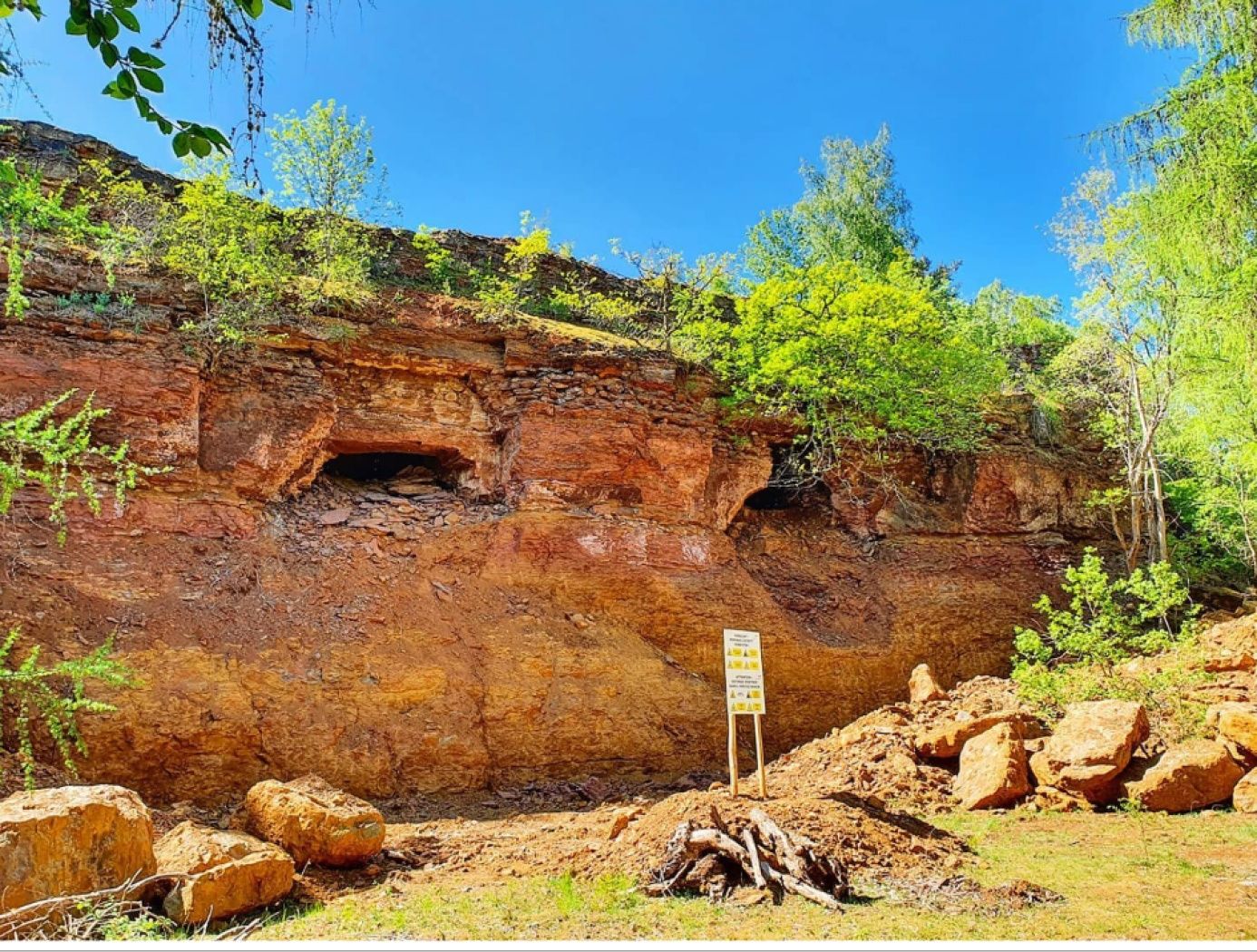
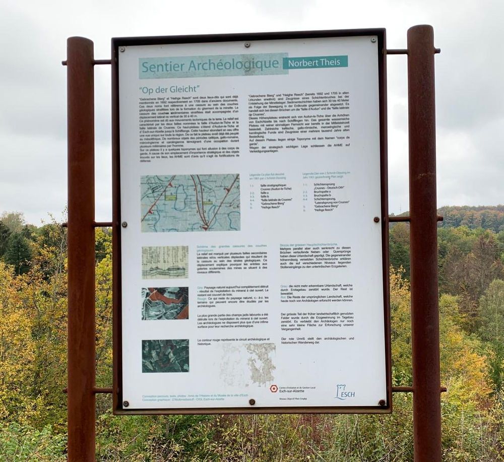
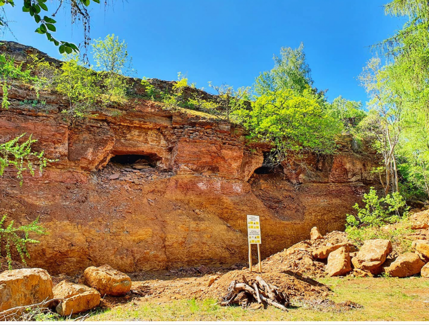
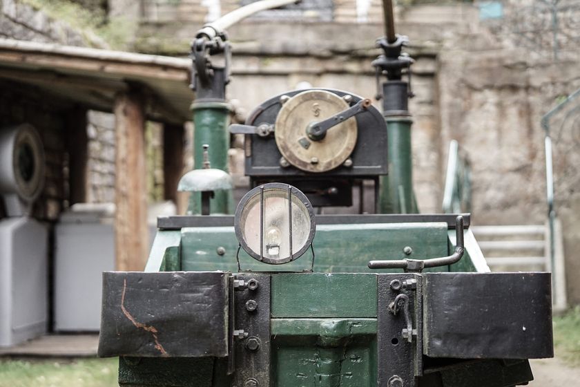
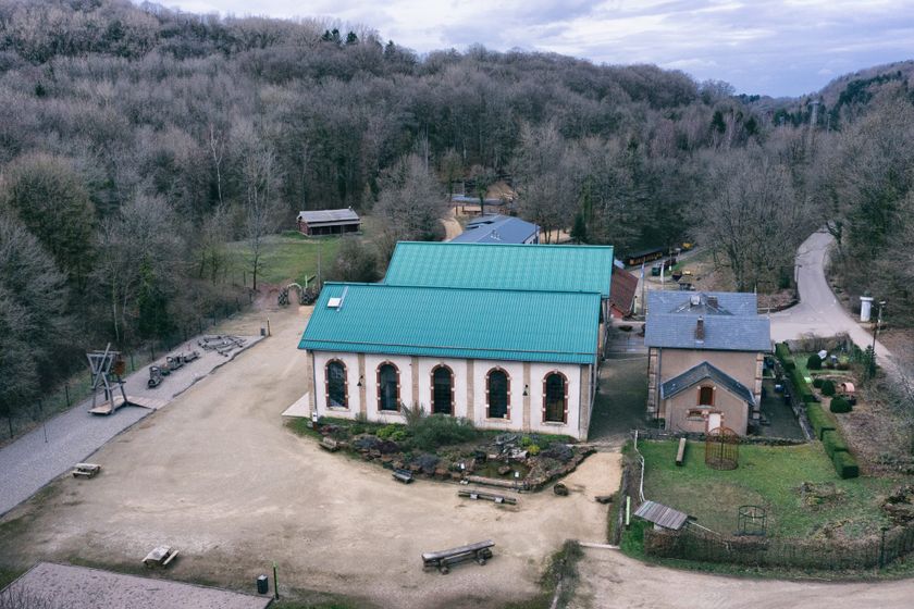
Hiking through history

During this hike you can follow in the footsteps of the historian Norbert Theis and discover the multi-millennial history of the area’s iron metropolis.

Suggestions nearby

Local hiking trail Esch: Sentier Norbert Theis Trail – 7km

  • ©ORT SUD
    Mountain Bike service station - Ellergronn
    An ideally located repair and washing station
    Find out more
  • ©Pancake!
    Playground Centre nature et forêt Ellergronn
    Playground Centre nature et forêt Ellergronn
    Find out more
  • Kabaisercher: Pump it up!
    AccessibleParking
  • Minett - UNESCO Biosphere Reserve
    The Minett region - officially a UNESCO Biosphere Reserve
    Find out more
  • ©Ville d'Esch
    Escher Bamhauscafé
    Café
    Find out more
  • ©Ville d'Esch
    Escher Bamhaiser Gaalgebierg
    Garden / ParkSituated in the centre of townWifi
  • ©Pulsa Pictures ORT Sud
    Nature reserve "Ellergronn"
    From mining to nature reserve
    Find out more
  • ©Ville d'Esch
    Museum of the Cockerill Mine at Ellergronn
    Exceptional legacy from the mining era
    Find out more
  • ©Ville d'Esch
    Centre nature et forêt Ellergronn
    Experience the diversity of nature and learn more about the relationships in the nature reserves
    Find out more

Similar hiking tours

©Ville de Dudelange, Ville de Dudelange
Circular routes
Local hiking trail Dudelange - "Buerfousswee"
Distance: 0,64 km
Duration: 0:10 h
Difficulty: easy
Find out more
©Administration des Eaux et Forêts / LFT
Local hiking trail Esch: Sentier Pierre Wies trail – 8.5km
Distance: 10,60 km
Duration: 2:55 h
Difficulty: easy
Find out more
©Pulsa Pictures, ORT SUD
Circular routes
Local hiking trail Esch: Burgronn - 3 km
Distance: 2,97 km
Duration: 0:45 h
Difficulty: easy
Find out more
©Visit Luxembourg
Circular routes
Auto-Pédestre Tadler hiking trail
Distance: 4,57 km
Duration: 1:30 h
Difficulty: easy
Find out more
©Visit Luxembourg
Thematic paths
Naturentdeckungspfad Cactusbësch
Distance: 6,09 km
Duration: 1:50 h
Difficulty: easy
Find out more
©Visit Luxembourg
Thematic paths
With Robi through the forest
Distance: 2,82 km
Duration: 0:45 h
Difficulty: easy
Find out more
©©Visit Éislek
Éischter Bëschrou
Distance: 4,33 km
Duration: 1:10 h
Difficulty: easy
Find out more
©Jeniska Photography, Visit Luxembourg
Guttland.Trails
Guttland.Trail Fautelfiels
Distance: 5,40 km
Duration: 1:45 h
Difficulty: easy
Find out more
©Pancake! Photographie, Visit Guttland
Thematic paths
Nature walk 'Meditation path' Rindschleiden
Distance: 1,49 km
Duration: 0:25 h
Difficulty: easy
Find out more
outdooractive This website uses technology and content from the Outdooractive Platform.