©Carlo Rinnen, Visit Luxembourg
Mosel Germany France

Auto-Pédestre hiking route Wormeldange

Hunting Season 2025/26 — Check for hunts

Autumn is here, and that means hunting season has begun! From mid-October to January/February, hunters are active across the country. Stay safe by checking hunt dates in your area on our Map. 

Click on Map in the Header > Services > More > Hunting.

Starting point

Parking Friedhof, Wormeldange

Destination

Parking Friedhof, Wormeldange

Distance
7,05 km
Duration
2:05 h
Difficulty
medium
  • Condition
Highest point
247 Hm
Lowest point
140 Hm
Aggregated Ascent
230 Hm
Aggregated Descent
230 Hm
Circular routes Visit Luxembourg

Description

Scenic Refreshment stops available

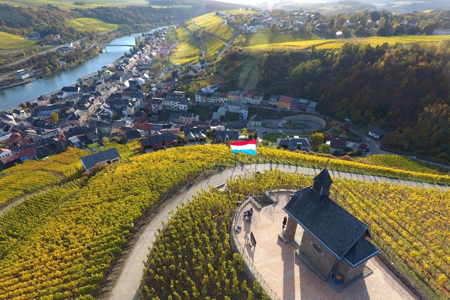
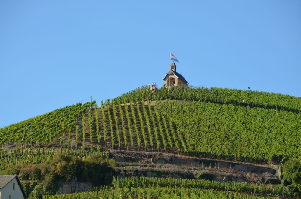
The highlight of this route is the view from the chapel at Wormer Koeppchen with a great view over the Moselle Valley.

Starting from the wine cooperative, this path leads into the village center of Wormeldange before heading into the vineyards towards Ehnen. From here, the path leads to Wormeldange-Haut and further up to the heights of the "Koeppchen." In the famous Riesling vineyard Koeppchen, the path leads to the Donatus Chapel with its magnificent viewpoint over the Moselle Valley. From here, the path loops back down to the valley to the starting point.

Suggestions nearby

Auto-Pédestre hiking route Wormeldange


  • No image available
    Domaine viticole Serge & Martine Wagener-Schmit
    Domaine viticole Serge & Martine Wagener-Schmit
    Find out more
  • ©Domaines Vinsmoselle
    Domaines Vinsmoselle - Caves des Crémants Poll Fabaire Wormeldange
    Caves Crémants Poll-Fabaire: a prestigious winery
    Find out more
  • ©Anabela and Jorge Valente - diariesof
    "Wormer Koeppchen"
    "Wormer Koeppchen"
    Find out more
  • Distillery André Weber
    Distillery André Weber
    Find out more
  • ©Restaurant Koeppchen
    Restaurant Koeppchen
    Restaurant Koeppchen
    Find out more

Similar hiking tours

©Visit Luxembourg
Circular routes
Auto-Pédestre route Lieler
Distance: 7,85 km
Duration: 2:15 h
Difficulty: medium
Find out more
©Visit Luxembourg
Circular routes
Auto-Pédestre hiking route Roder
Distance: 7,64 km
Duration: 2:30 h
Difficulty: medium
Find out more
©Pulsa Pictures, ORT SUD
Thematic paths
Nature walk "Natura 2000" - Ellergronn
Distance: 11,89 km
Duration: 3:10 h
Difficulty: medium
Find out more
©Visit Luxembourg
Circular routes
Auto-Pédestre Hiking Trail Dahl
Distance: 9,05 km
Duration: 2:45 h
Difficulty: medium
Find out more
©Visit Luxembourg
Circular routes
Auto-Pédestre Baschleiden route
Distance: 8,55 km
Duration: 2:40 h
Difficulty: medium
Find out more
©Lynn Schüssler, Visit Luxembourg
Éislek Pied
Éislek Pad Heinerscheid
Distance: 15,84 km
Duration: 4:50 h
Difficulty: medium
Find out more
©Visit Luxembourg
Circular routes
Auto-Pédestre Hiking Trail Consthum
Distance: 7,72 km
Duration: 2:15 h
Difficulty: medium
Find out more
©Visit Luxembourg
Circular routes
Auto-Pédestre Hiking Route Wahlhausen
Distance: 9,11 km
Duration: 2:50 h
Difficulty: medium
Find out more
©Visit Éislek, Visit Éislek
Circular routes
Auto-Pédestre Wiltz route
Distance: 13,29 km
Duration: 3:55 h
Difficulty: medium
Find out more
outdooractive This website uses technology and content from the Outdooractive Platform.