©Visit Luxembourg
Mosel Germany France

Auto-pedestrian hiking trail Schengen

Hunting Season 2026/27 — Check for hunts

Autumn is here, and that means hunting season has begun! From mid-October to January/February, hunters are active across the country. Stay safe by checking hunt dates in your area on our Map. 

Click on Map in the Header > Services > More > Hunting.

Starting point

Schengen under the Moselle bridge (Centre Européen)

Destination

Schengen under the Moselle bridge (Centre Européen)

Distance
5,40 km
Duration
1:30 h
Difficulty
easy
  • Condition
Highest point
230 Hm
Lowest point
142 Hm
Aggregated Ascent
174 Hm
Aggregated Descent
174 Hm
Circular routes Visit Luxembourg

Description

Refreshment stops available

Schengen circular hiking route

We first hike along the Moselle and gradually climb through vineyards to the heights of the Stromberg (viewpoint). From here, the path leads us down to Schengen, across the main street, then on a loop over the Markusberg to the Markusturm (viewpoint with statue of St. Mark). From there, it goes back to the starting point.

Suggestions nearby

Auto-pedestrian hiking trail Schengen

  • ©Schengen ASBL
    Natural conservation area "Strombierg"
    The nature reserve Strombierg has a lot to offer.
    Find out more
  • ©Migliore+Servetto Ph Andrea Martiradonna
    free
    with theLuxembourgPass
    Schengen Museum
    The new Schengen Museum is more than an exhibition: it’s a dynamic, borderless experience. Here, visitors engage with history and ideas in immersive spaces designed to spark reflection and connection.
    Find out more
  • Markusbierg & Markustuerm
    Markusbierg & Markustuerm
    Find out more
  • ©VisitLuxembourg
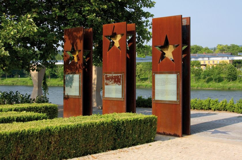
    Monument "Schengen Agreement"
    In Schengen, the monument to the "Schengen Agreement" commemorates the signing of the Schengen Agreement.
    Find out more

Similar hiking tours

©Ville de Dudelange, Ville de Dudelange
Circular routes
Local hiking trail Dudelange - "Buerfousswee"
Distance: 0,64 km
Duration: 0:10 h
Difficulty: easy
Find out more
©Pancake!
Circular routes
Nature walk Natura 2000 - Boucle A: « L’homme et la forêt » – 5 km
Distance: 5,51 km
Duration: 1:30 h
Difficulty: easy
Find out more
©KuFa
Circular routes
Nature walk Natura 2000 - Boucle C: "La succession végétale sur un ancien territoire minier" – 2,5 km
Distance: 2,68 km
Duration: 0:45 h
Difficulty: easy
Find out more
©ORT SUD
Circular routes
Local hiking trail Esch: Sentier Norbert Theis Trail – 7km
Distance: 7,98 km
Duration: 2:15 h
Difficulty: easy
Find out more
©Pulsa Pictures, ORT SUD
Circular routes
Local hiking trail Esch: Burgronn - 3 km
Distance: 2,97 km
Duration: 0:45 h
Difficulty: easy
Find out more
©Visit Luxembourg
Circular routes
Auto-Pédestre Hiking Trail Büderscheid
Distance: 4,64 km
Duration: 1:20 h
Difficulty: easy
Find out more
©Luxembourg for Tourism
Circular routes
Auto-Pédestre Bourscheid route
Distance: 5,88 km
Duration: 2:05 h
Difficulty: easy
Find out more
©ORT Sud
Circular routes
Local hiking route "Parc Le'h" - children’s route
Distance: 1,46 km
Duration: 0:25 h
Difficulty: easy
Find out more
©Visit Luxembourg
Circular routes
Auto-Pédestre Hiking Route Eschweiler
Distance: 7,05 km
Duration: 1:55 h
Difficulty: easy
Find out more
outdooractive This website uses technology and content from the Outdooractive Platform.