©Visit Luxembourg
Mosel Germany France

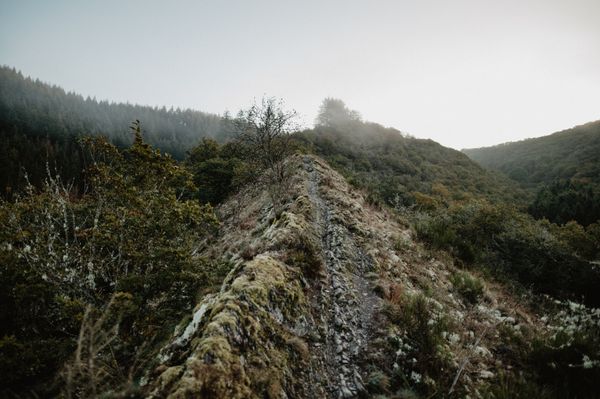
Betzder Panorama Route

Hunting Season 2026/27 — Check for hunts

Autumn is here, and that means hunting season has begun! From mid-October to January/February, hunters are active across the country. Stay safe by checking hunt dates in your area on our Map. 

Click on Map in the Header > Services > More > Hunting.

Starting point

Betzdorf train station - 7, Rue de la Gare 6832 Betzdorf
Destination

Betzdorf train station - 7, Rue de la Gare 6832 Betzdorf

Distance
40,42 km
Duration
1118:00 h
Difficulty
difficult
  • Condition
Highest point
399 Hm
Lowest point
220 Hm
Aggregated Ascent
847 Hm
Aggregated Descent
847 Hm
Circular routes Visit Luxembourg

Description

Betzder Panorama-Tour

A HIKING ROUTE OVER THE HEIGHTS OF THE MUNICIPALITY OF BETZDORF

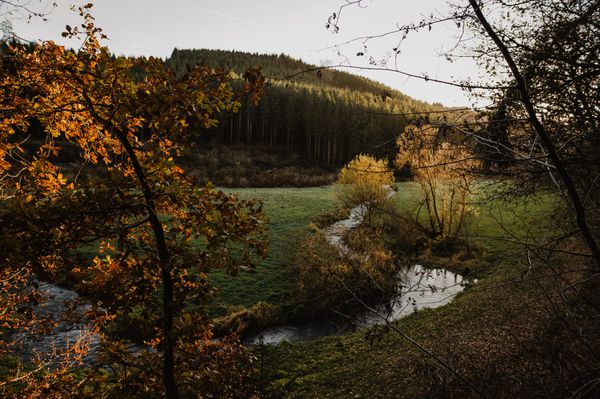
The Panorama Route is a circular route of 40.5 km that surrounds the municipality and runs along the hill chains on the edge of the Syrtal, offering a splendid view over the valley and the different villages. Because of its length, the route is divided into 6 stages.

Current conditions

Source: Visit Luxembourg, Published: 2026-10-15
Deviation on the Betzder Panorama-Tour hiking trail due to forestry work
Notice: For the local hiking trail Betzder Panorama-Tour, please follow CFL 42 Manternach – Betzdorf to Berg, then take the deviation to Olingen.

The closure also applies on weekends!

Thank you for your understanding and cooperation.

Duration: +/- end of February 2027.

Suggestions nearby

Betzder Panorama Route

  • Peitry Restauberge
    Peitry Restauberge
    Find out more

Similar hiking tours

©Visit Éislek, Visit Éislek
Éislek Pied
Éislek Pad Troisvierges
Distance: 19,34 km
Duration: 5:45 h
Difficulty: difficult
Find out more
©Pulsa Pictures, ORT SUD
Circular routes
Local hiking trail "Fitness & Promenades 7" (black)
Distance: 12,84 km
Duration: 3:30 h
Difficulty: difficult
Find out more
©Visit Luxembourg
Thematic paths
Sound Walk
Distance: 5,76 km
Duration: 1:45 h
Difficulty: difficult
Find out more
©Dominik Ketz, ferienregion-felsenland-suedeifel-eifel-rlp
NaturWanderPark Delux
NaturWanderPark delux: Rock Path 1 (L-Echternach)
Distance: 20,35 km
Duration: 6:00 h
Difficulty: difficult
Find out more
©Pulsa Pictures, ORT SUD
Circular routes
Local hiking trail "Fitness & Promenades 5" (Brown)
Distance: 11,13 km
Duration: 3:05 h
Difficulty: difficult
Find out more
©Stad Rëmeleng
Circular routes
Local hiking trail "Fitness & Promenades 6" (gray)
Distance: 12,46 km
Duration: 3:25 h
Difficulty: difficult
Find out more
©D. Ketz, Eifel Tourismus GmbH, D. Ketz
NaturWanderPark Delux
NaturWanderPark delux: Felsenweg 3 (D-Ferschweiler/L-Berdorf)
Distance: 24,66 km
Duration: 6:30 h
Difficulty: difficult
Find out more
©Visit Luxembourg
NaturWanderPark Delux
NaturWanderPark delux: Felsenweg 4
Distance: 32,57 km
Duration: 9:35 h
Difficulty: difficult
Find out more
©Visit Luxembourg
Circular routes
Local Hiking Trail PH 2 - Hoscheid
Distance: 7,07 km
Duration: 2:15 h
Difficulty: difficult
Find out more
outdooractive This website uses technology and content from the Outdooractive Platform.