Luxembourg City Éislek Müllerthal Mosel Minett Guttland Germany France

Ourdall Promenade

Starting point

Stolzembourg / Vianden

Destination

Vianden / Stolzembourg

Distance

8,78 km

Duration

2:25 h

Difficulty

medium

  • Condition

Highest point

82 Hm

Lowest point

62 Hm

Thematic paths Visit Éislek

Description
Accessible to all

The variety of themed trails not only shows you the beautiful natural landscapes of the region, but also provides information on a wide range of topics.

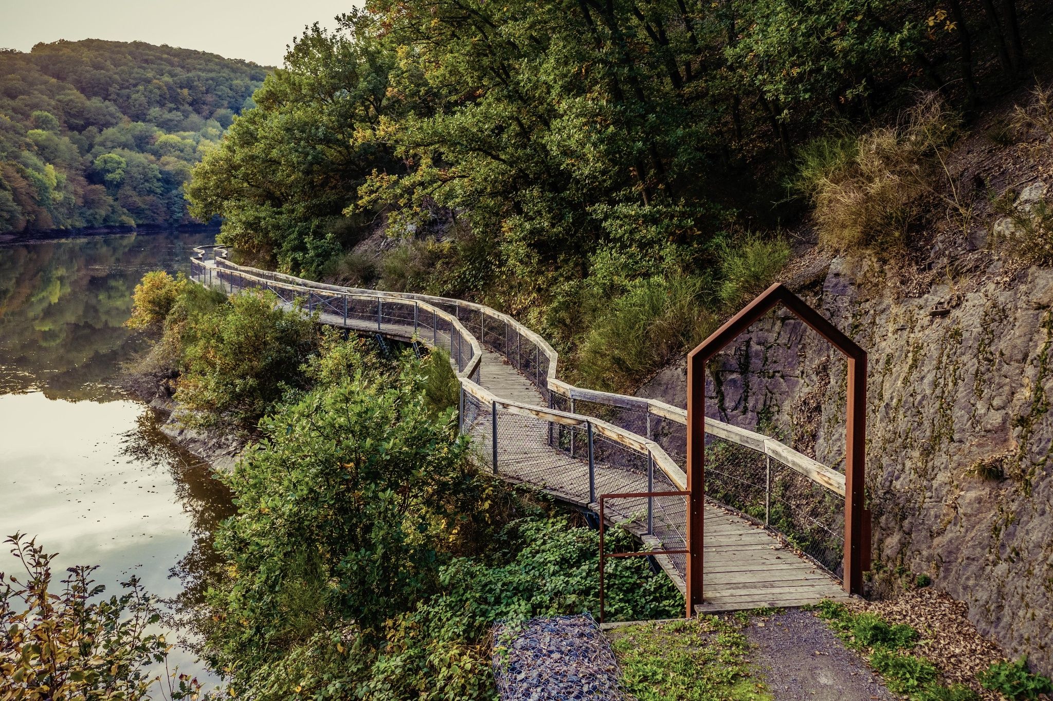
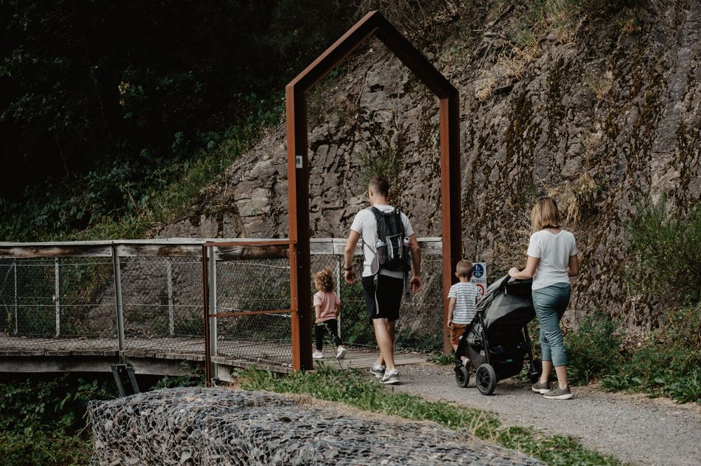
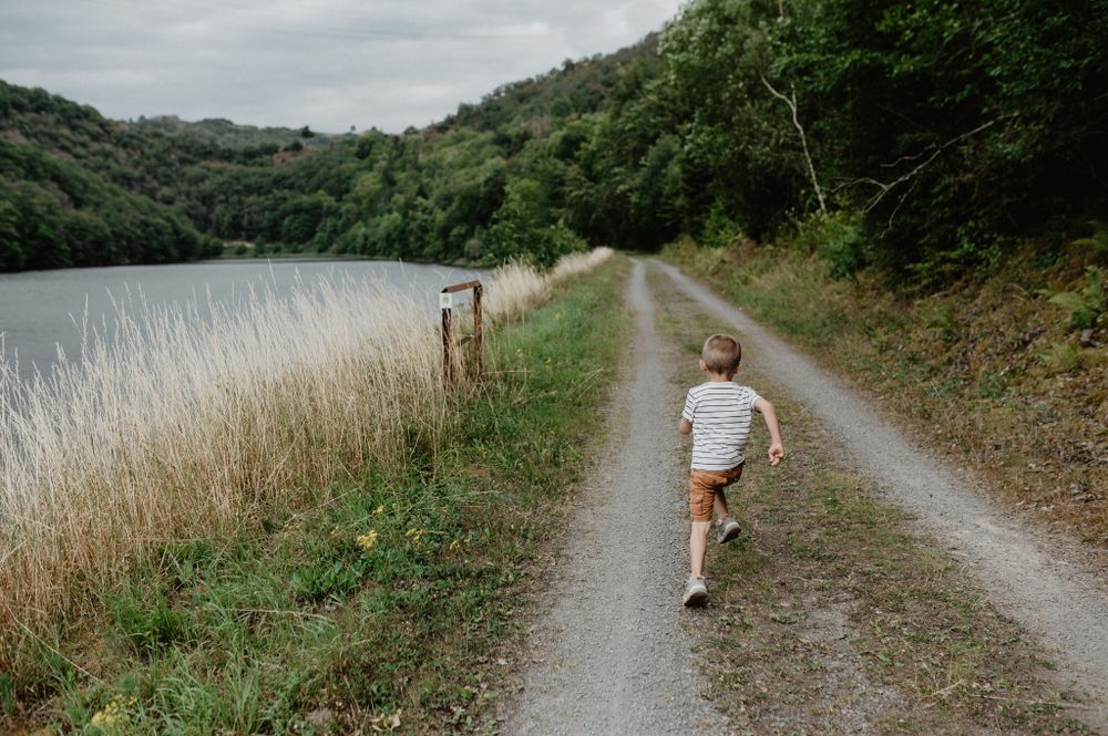
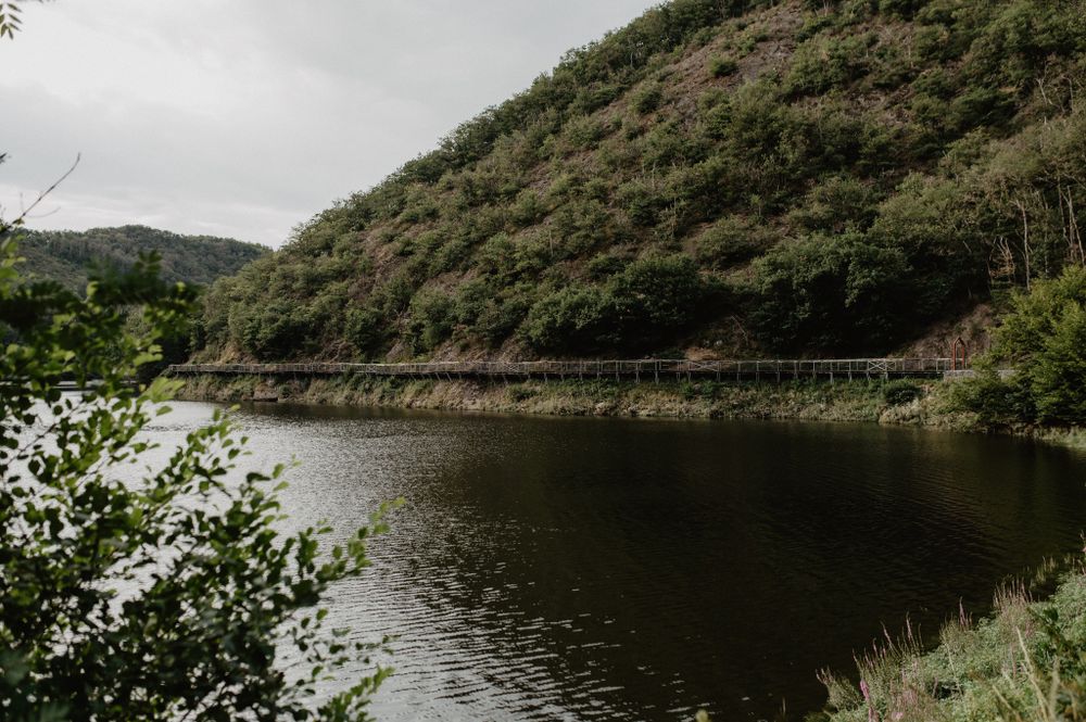
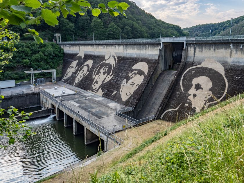
The "Ourdall Promenade" invites you to discover the Our valley between Vianden and Stolzembourg. When you start in Vianden, you will soon climb a small hill where you will cross the Our dam. This very special path leads partly over wooden footbridges directly along the rock. Don't forget to turn around and enjoy the view of Vianden Castle and the Bildchen Chapel. The trail continues via Bivels to Stolzembourg, where you can take the bus back to Vianden.

for tour routing
trail-ourdall-promenade gpx
Plan your journey

Tour feedback

Report a problem

Suggestions nearby

Ourdall Promenade

  • Vianden Castle
    free
    with theLuxembourgCard

    Where? Montée du Château, L-9408 Vianden

    Vianden Castle

    Vianden Castle: An outstanding monument

    Find out more

Similar hiking tours

Distance trails
21 Station to station Bettembourg - Dudelange-Burange

Distance: 14,68 km
Duration: 3:45 h
Difficulty: medium

Find out more
Distance trails
22 Station to Station Dudelange - Burange - Rumelange

Distance: 10,28 km
Duration: 3:00 h
Difficulty: medium

Find out more
Distance trails
23 Station to station Rumelange - Kayl

Distance: 12,64 km
Duration: 3:25 h
Difficulty: medium

Find out more
Distance trails
25 Station to station Kayl - Schifflange - Esch-sur-Alzette

Distance: 21,80 km
Duration: 6:00 h
Difficulty: medium

Find out more
Distance trails
26 Station to station Esch-sur-Alzette - Belvaux-Soleuvre

Distance: 9,06 km
Duration: 2:25 h
Difficulty: medium

Find out more
Distance trails
27 Station to station Belvaux-Soleuvre-Oberkorn

Distance: 5,20 km
Duration: 1:25 h
Difficulty: medium

Find out more
Distance trails
28 Station to station Oberkorn - Niederkorn

Distance: 8,68 km
Duration: 2:25 h
Difficulty: medium

Find out more
Distance trails
29 Station to station Niederkorn - Rodange

Distance: 10,16 km
Duration: 2:55 h
Difficulty: medium

Find out more
Distance trails
30 Station to station Oberkorn - Fond de Gras - Rodange

Distance: 17,83 km
Duration: 4:55 h
Difficulty: medium

Find out more
outdooractive This website uses technology and content from the Outdooractive Platform.