© Carlo Rinnen, Visit Luxembourg
Mosel Germany France

Viticultural trail

Starting point
Wormeldange, Caves Poll-Fabaire
Destination
Wormeldange, Caves Poll-Fabaire
Distance
3,22 km
Duration
1:00 h
Difficulty
medium
  • Condition
Highest point
252 Hm
Lowest point
140 Hm
Aggregated Ascent
117 Hm
Aggregated Descent
117 Hm
Visit Luxembourg

Description

Viticultural trail

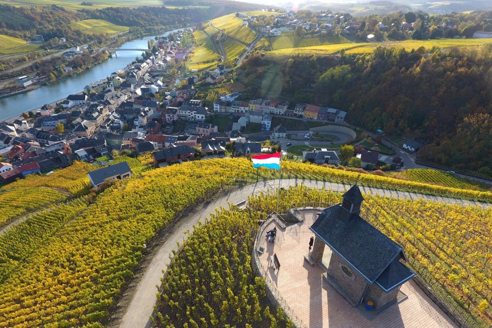
Starging from the Winegrowers Cooperative (tours are an option), the path leads through the lower part of the area and then up to the heights of the Koeppchen. In the famous vineyard site “Koeppchen“, two ideal conditions meet: perfect soil, namely shell lime, and the exact southern exposure of the slope, so that the king of wines, Riesling, can thrive at its most magnificent. We make a little loop at the Donatuskapelle and descend to the starting point at the Mosel.

Suggestions nearby

Viticultural trail

  • Domaines Vinsmoselle - Caves des Crémants Poll Fabaire Wormeldange
    Caves Crémants Poll-Fabaire: a prestigious winery
    Find out more

Similar hiking tours

© Visit Luxembourg
Distance trails
21 Station to station Bettembourg - Dudelange-Burange
Distance: 14,66 km
Duration: 3:45 h
Difficulty: medium
Find out more
© CFL, Visit Luxembourg
Distance trails
22 Station to Station Dudelange - Burange - Rumelange
Distance: 10,22 km
Duration: 3:05 h
Difficulty: medium
Find out more
© ORT Sud
Distance trails
23 Station to station Rumelange - Kayl
Distance: 12,57 km
Duration: 3:25 h
Difficulty: medium
Find out more
© Visit Luxembourg
Distance trails
25 Station to station Kayl - Schifflange - Esch-sur-Alzette
Distance: 21,71 km
Duration: 6:05 h
Difficulty: medium
Find out more
© Pulsa Pictures, ORT SUD
Distance trails
26 Station to station Esch-sur-Alzette - Belvaux-Soleuvre
Distance: 9,05 km
Duration: 2:30 h
Difficulty: medium
Find out more
© Visit Luxembourg
Distance trails
27 Station to station Belvaux-Soleuvre-Oberkorn
Distance: 5,20 km
Duration: 1:25 h
Difficulty: medium
Find out more
© ORT Sud
Distance trails
28 Station to station Oberkorn - Niederkorn
Distance: 8,69 km
Duration: 2:25 h
Difficulty: medium
Find out more
© ORT Sud
Distance trails
29 Station to station Niederkorn - Rodange
Distance: 10,12 km
Duration: 2:55 h
Difficulty: medium
Find out more
© Visit Luxembourg
Distance trails
30 Station to station Oberkorn - Fond de Gras - Rodange
Distance: 17,78 km
Duration: 5:00 h
Difficulty: medium
Find out more