Description
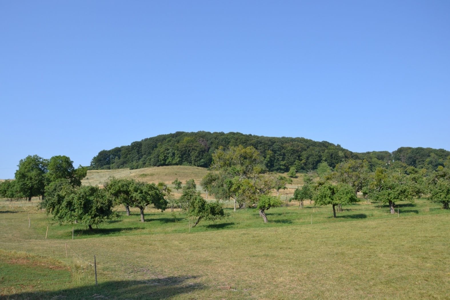
On this somewhat longer (11 km) circular hiking route, forest, meadow, and field alternate pleasantly with villages. There are some distant views over the plateaus.
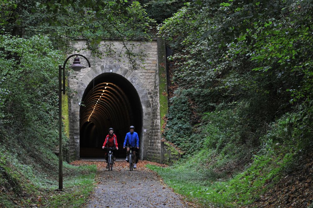
This route initially follows a cycle path along the old Luxembourg - Echternach railway line. You walk through the tunnel in Bech, which served as a railway tunnel until 1954. Then it goes uphill to Altrier, past an old wash fountain. After hiking back to Bech, the hiking trail takes a detour east of Bech. On this section, you get a small preview of the region's rock landscape before bypassing the Hirzbierg in a large curve and then returning to the starting point.
Equipment
Sturdy footwear and something to drink.
Journey
Nearest bus stop: Bech, Beim Weiher (100 m)
Nearest parking: Eglise/Mairie (100 m)
Parking:
There is a parking lot directly at the starting point.


 This website uses technology and content from the Outdooractive Platform.