© Visit Luxembourg
Éislek Germany France

Auto-Pédestre hike Boulaide

Hunting Season 2025/26 — Check for hunts

Autumn is here, and that means hunting season has begun! From mid-October to January/February, hunters are active across the country. Stay safe by checking hunt dates in your area on our Map. 

Click on Map in the Header > Services > More > Hunting.

Starting point

16 Rue du Curé, Boulaide

Destination

16 Rue du Curé, Boulaide

Distance
9,26 km
Duration
2:50 h
Difficulty
medium
  • Condition
Highest point
459 Hm
Lowest point
328 Hm
Aggregated Ascent
250 Hm
Aggregated Descent
250 Hm
Circular routes Visit Luxembourg

Description

Scenic

Boulaide, located directly on the Sauer and just before the Obersauer reservoir, convinces with its beautiful, natural landscape.

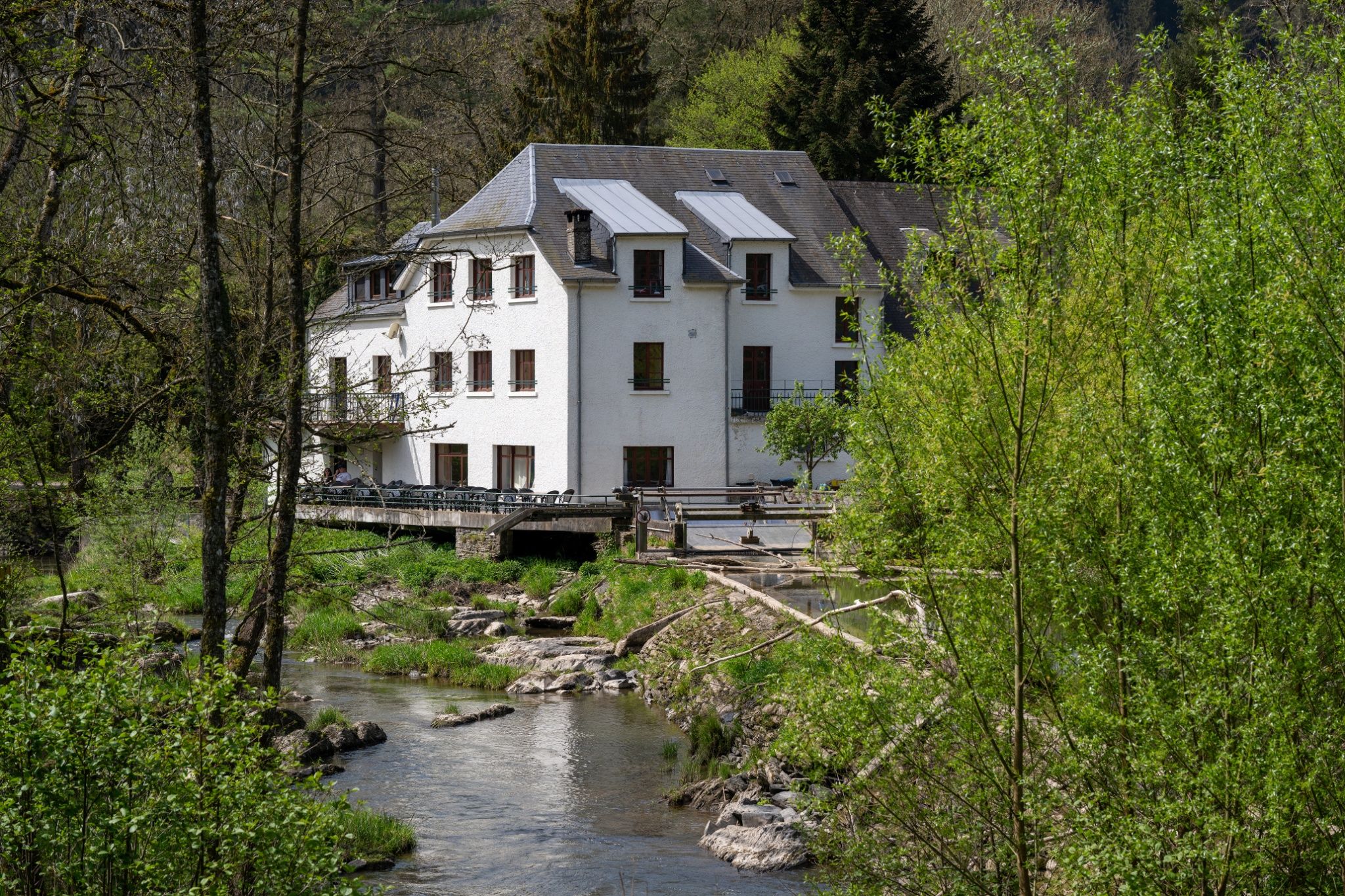
The Auto-Pédestre Boulaide starts in the village center and heads west along the Bällerbaach to Bauscheltermillen, a mill from the 14th century that is still inhabited today. Here, the Bällerbaach also flows into the Sauer.

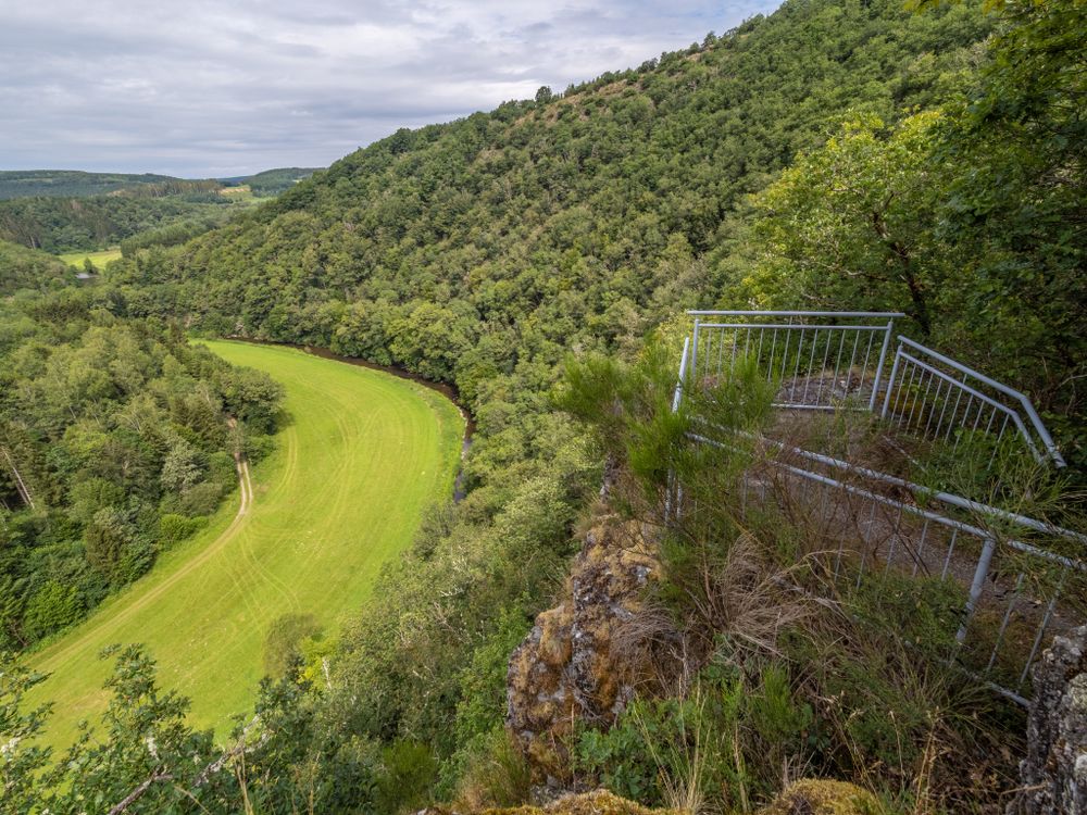
Shortly after, the hiking path crosses the Sauer and leads south towards Bungerefermillen, the Bondorfer Mill, where it crosses the Sauer again. Through the forest, it goes steeply uphill to Houfëls. Here you can not only take a well-deserved break but also enjoy the panoramic view over the beautiful Obersauer valley.

Downhill it goes almost to the shore of the Sauer, past Neimillebierg. Shortly before it meets the Bauschelbaach, the hiking path turns back. It quickly leads back to the little brook, which it follows almost until returning to Boulaide. This last part of the hike goes uphill through meadows.

Suggestions nearby

Auto-Pédestre hike Boulaide

  • © Visit Éislek
    Houfëls
    The ‘Houfëls’ (high rock) viewpoint near Boulaide offers a breathtaking view over the Sûre Valley and the Upper Sûre.
    Find out more

Similar hiking tours

© Visit Luxembourg
Circular routes
Auto-Pédestre trail Heiderscheid
Distance: 7,97 km
Duration: 2:25 h
Difficulty: medium
Find out more
© Visit Éislek, Visit Éislek
Circular routes
Auto-Pédestre hiking route Esch-Sur-Sûre
Distance: 9,72 km
Duration: 3:10 h
Difficulty: medium
Find out more
© Pulsa Pictures, ORT SUD
Thematic paths
Didactic trail "Natura 2000" - Ellergronn
Distance: 11,89 km
Duration: 3:10 h
Difficulty: medium
Find out more
© Visit Luxembourg
Circular routes
Auto-Pédestre trail Holtz
Distance: 8,92 km
Duration: 2:30 h
Difficulty: medium
Find out more
© Visit Luxembourg
Circular routes
Auto-Pédestre trail Arsdorf
Distance: 11,05 km
Duration: 3:10 h
Difficulty: medium
Find out more
© Visit Luxembourg
Circular routes
Auto-Pédestre trail Stolzembourg
Distance: 7,59 km
Duration: 2:15 h
Difficulty: medium
Find out more
© Visit Luxembourg
Circular routes
Auto-Pédestre trail Goesdorf
Distance: 6,87 km
Duration: 2:10 h
Difficulty: medium
Find out more
© Visit Luxembourg
Circular routes
Auto-Pédestre trail Wilwerwiltz
Distance: 9,65 km
Duration: 2:50 h
Difficulty: medium
Find out more
© Visit Luxembourg
Circular routes
Auto-Pédestre Hiking Trail Kaundorf
Distance: 8,51 km
Duration: 2:25 h
Difficulty: medium
Find out more
outdooractive This website uses technology and content from the Outdooractive Platform.