© L. Schömer, Visit Luxembourg
Müllerthal Germany France

Auto-pédestre trail Bourglinster

Starting point
Bourglinster: Place du village
Destination
Bourglinster: Place du village
Distance
7,96 km
Duration
2:15 h
Difficulty
medium
  • Condition
  • Technique
Highest point
406 Hm
Lowest point
311 Hm
Aggregated Ascent
133 Hm
Aggregated Descent
133 Hm
Circular routes Visit Luxembourg

Description

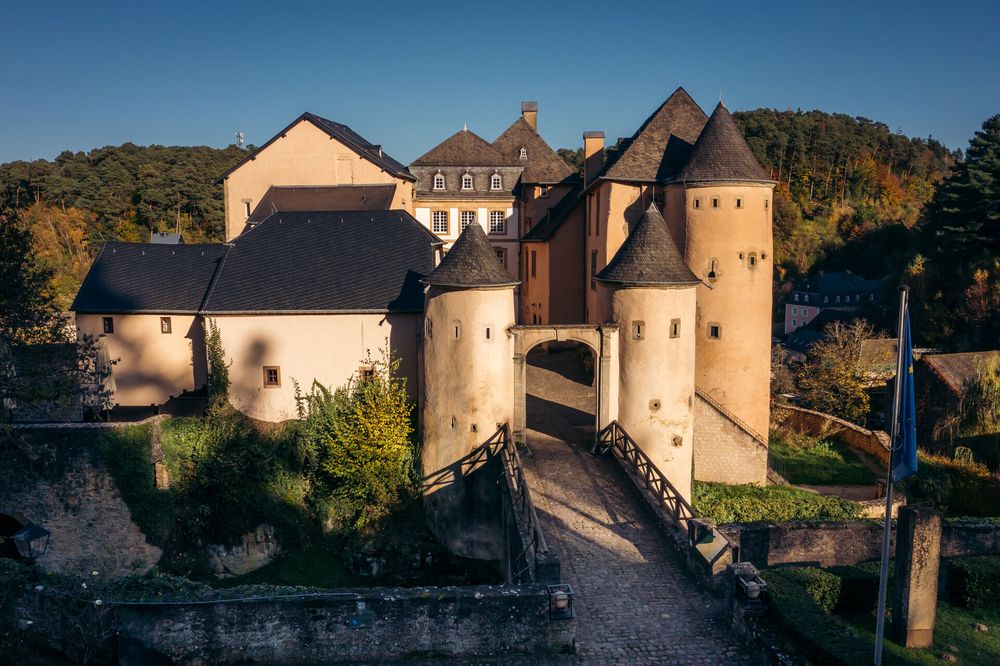
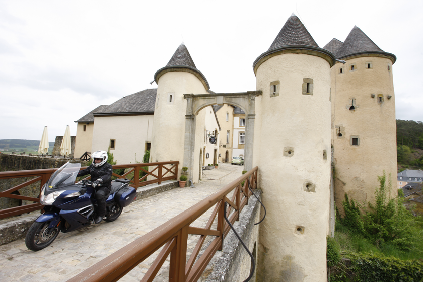
This is a pleasant hike which you start in the picturesque village of Bourglinster. You will get wonderful views of the castle of Bourglinster

This path runs through several forests - such as the Buchhëlz and the Bambësch and follows the national hiking trail "Sentier du Mëllerdall" along the town of Eisenborn. Highlights are the castle in Bourglinster (visits only on request) and the tranquil centerof the village.

Suggestions nearby

Auto-pédestre trail Bourglinster

  • © Jason Critchell MOTO / LFT
    Bourglinster Castle
    A renowned restaurant is within the castle walls.
    Find out more
  • Parking - Castle Bourglinster
    Parking - Castle Bourglinster
    Find out more

Similar hiking tours

© © Wanderbüro Saar-Hunsrück, Klaus-Peter Kappest, SaarSchleifenLand
Dream loops
"Traumschleife" Schengen without borders
Distance: 8,54 km
Duration: 3:30 h
Difficulty: medium
Find out more
© Visit Luxembourg
Distance trails
21 Station to station Bettembourg - Dudelange-Burange
Distance: 14,66 km
Duration: 3:45 h
Difficulty: medium
Find out more
© CFL, Visit Luxembourg
Distance trails
22 Station to Station Dudelange - Burange - Rumelange
Distance: 10,22 km
Duration: 3:05 h
Difficulty: medium
Find out more
© Visit Minett, Visit Minett
Distance trails
23 Station to station Rumelange - Kayl
Distance: 12,57 km
Duration: 3:25 h
Difficulty: medium
Find out more
© Visit Luxembourg
Distance trails
25 Station to station Kayl - Schifflange - Esch-sur-Alzette
Distance: 21,71 km
Duration: 6:05 h
Difficulty: medium
Find out more
© Pulsa Pictures_ORT SUD, Visit Luxembourg
Distance trails
26 Station to station Esch-sur-Alzette - Belvaux-Soleuvre
Distance: 9,05 km
Duration: 2:30 h
Difficulty: medium
Find out more
© Visit Luxembourg
Distance trails
27 Station to station Belvaux-Soleuvre-Oberkorn
Distance: 5,20 km
Duration: 1:25 h
Difficulty: medium
Find out more
© ORT Sud, Visit Luxembourg
Distance trails
28 Station to station Oberkorn - Niederkorn
Distance: 8,69 km
Duration: 2:25 h
Difficulty: medium
Find out more
© ORT Sud, Visit Luxembourg
Distance trails
29 Station to station Niederkorn - Rodange
Distance: 10,12 km
Duration: 2:55 h
Difficulty: medium
Find out more