© Visit Luxembourg
Müllerthal Germany France

Auto-pédestre trail Berdorf

Starting point
Berdorf: 1,Rue d'Echternach
Destination
Berdorf: 1,Rue d'Echternach
Distance
6,63 km
Duration
1:49 h
Difficulty
medium
  • Condition
  • Technique
Highest point
375 Hm
Lowest point
280 Hm
Aggregated Ascent
95 Hm
Aggregated Descent
95 Hm
Circular routes Visit Luxembourg

Description

Refreshment stops available

This hiking trail takes you right into the fascinating rocky world of the region and to two geological highlights: the Perekop and the Huel Lee.

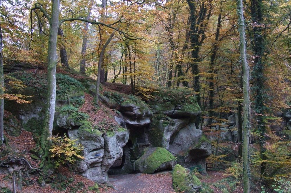
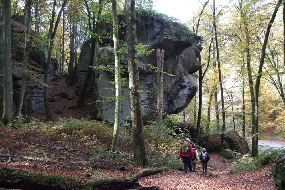
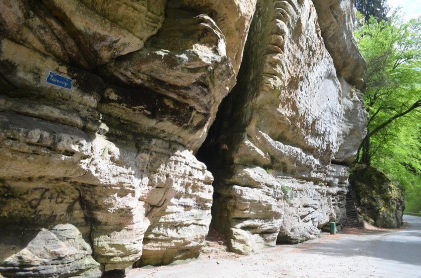
This hiking trail initially leads along fields over the Berdorf plateau and offers wonderful views of the landscape. You then plunge into the rocky landscape. After a detour along the Halsbaach, past places with illustrious names such as "Wëllkeschkummer" and "Zigeinerlee", the path continues down into the Aesbaach valley. A geological highlight is waiting there for you: the Perekop. This is a rock that you can climb via a ladder.

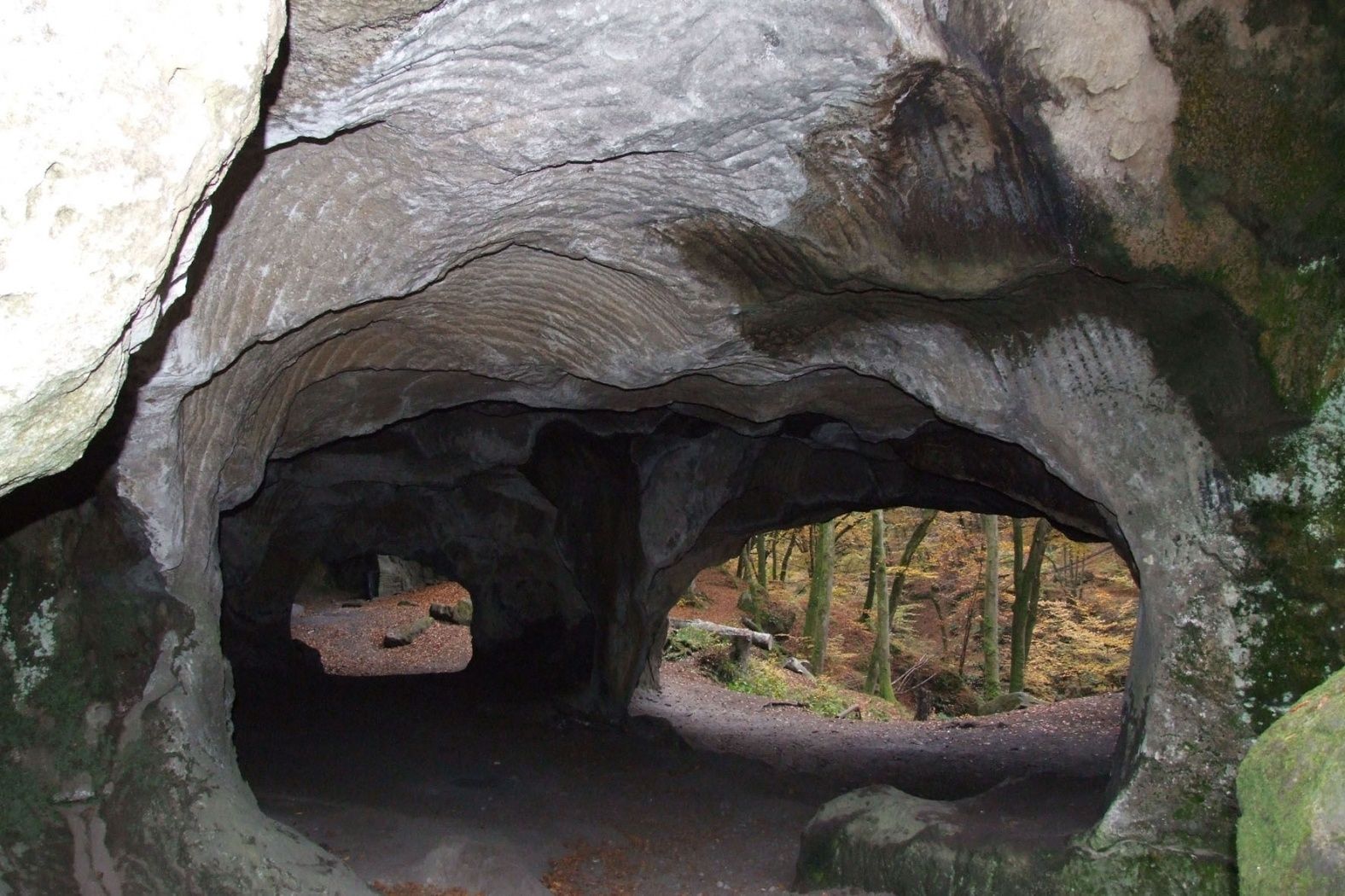
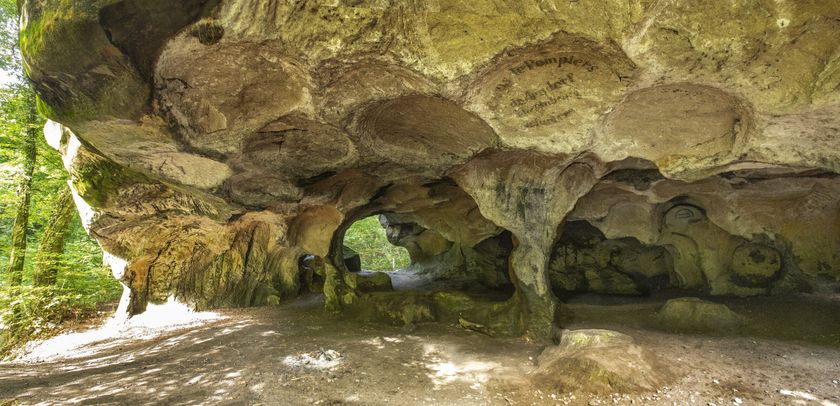
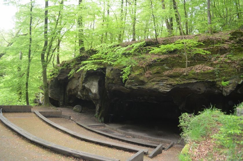
You continue on the Mullerthal Trail through the enchanting rocky landscape until the "Huel Lee", a man-made cave. An information board provides information about the creation of these rocks.

From there the path takes you slightly uphill again, back to Berdorf. The village offers many places to stop for a break and shop.


Please make sure to enable your Cookies in case you don't see this content.

Suggestions nearby

Auto-pédestre trail Berdorf

  • Rock formation "Huel Lee/Hohllay"
    Fascinating cave created by the extraction of millstones.
    Find out more
  • Rock formation "Perekop"
    You can climb up the crevice in this impressive rock giant along the main road from Echternach to Berdorf and enjoy the view from the top
    Find out more
  • Boutique Berdorfer Eck
    Boutique Berdorfer Eck
    Find out more
  • © Bistro/Restaurant Berdorfer Eck
    Restaurant "Victoria vum Berdorfer Eck"
    Seasonal and local
    Find out more
  • Amphitheater Breechkaul
    Amphitheater where rocks had been hollowed out to gain millstones
    Find out more

Similar hiking tours

© © Wanderbüro Saar-Hunsrück, Klaus-Peter Kappest, SaarSchleifenLand
Dream loops
"Traumschleife" Schengen without borders
Distance: 8,54 km
Duration: 3:30 h
Difficulty: medium
Find out more
© Visit Luxembourg
Distance trails
21 Station to station Bettembourg - Dudelange-Burange
Distance: 14,66 km
Duration: 3:45 h
Difficulty: medium
Find out more
© CFL, Visit Luxembourg
Distance trails
22 Station to Station Dudelange - Burange - Rumelange
Distance: 10,22 km
Duration: 3:05 h
Difficulty: medium
Find out more
© Visit Minett, Visit Minett
Distance trails
23 Station to station Rumelange - Kayl
Distance: 12,57 km
Duration: 3:25 h
Difficulty: medium
Find out more
© Visit Luxembourg
Distance trails
25 Station to station Kayl - Schifflange - Esch-sur-Alzette
Distance: 21,71 km
Duration: 6:05 h
Difficulty: medium
Find out more
© Pulsa Pictures_ORT SUD, Visit Luxembourg
Distance trails
26 Station to station Esch-sur-Alzette - Belvaux-Soleuvre
Distance: 9,05 km
Duration: 2:30 h
Difficulty: medium
Find out more
© Visit Luxembourg
Distance trails
27 Station to station Belvaux-Soleuvre-Oberkorn
Distance: 5,20 km
Duration: 1:25 h
Difficulty: medium
Find out more
© ORT Sud, Visit Luxembourg
Distance trails
28 Station to station Oberkorn - Niederkorn
Distance: 8,69 km
Duration: 2:25 h
Difficulty: medium
Find out more
© ORT Sud, Visit Luxembourg
Distance trails
29 Station to station Niederkorn - Rodange
Distance: 10,12 km
Duration: 2:55 h
Difficulty: medium
Find out more