© Visit Luxembourg
Mosel Germany France

In the centre of the village

Hunting Season 2025/26 — Check for hunts

Autumn is here, and that means hunting season has begun! From mid-October to January/February, hunters are active across the country. Stay safe by checking hunt dates in your area on our Map. 

Click on Map in the Header > Services > More > Hunting.

Starting point

Town hall Mondorf-les-Bains

Destination

Town hall Mondorf-les-Bains

Distance
2,73 km
Difficulty
easy
  • Condition
Highest point
210 Hm
Lowest point
190 Hm
Aggregated Ascent
26 Hm
Aggregated Descent
26 Hm
Circular routes Visit Luxembourg

Description

In the centre of the village

"Am Zentrum vum Duerf"

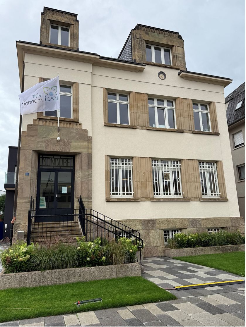
This hike is located in the heart of the municipality and combines relaxation and cultural discoveries. You will discover a part of the preserved historical heritage that has been preserved for years. On every street corner, you will notice that there is a story to tell. The starting point of this itinerary is at the Town Hall on the "Villes Jumelées" square, one of the most beautiful squares surrounded by shops. First you go towards the church of St. Michel, past the recently renovated synagogue and reach the French border. On your way back you will explore the so called "Stolpersteng" anchored in the ground. Finish your walk on the French shore to get back to the starting point.

Suggestions nearby

In the centre of the village

  • © Pancake! Photographie
    Aviation Museum
    Aviation technology past and present
    Find out more
  • © Restaurant Le Nid Gourmand - Hôtel Beau-Séjour
    Restaurant Le Nid Gourmand - Hôtel Beau-Séjour
    Restaurant Le Nid Gourmand - Hôtel Beau-Séjour
    Find out more
  • Tourist Info Mondorf-les-Bains
    Tourist Info Mondorf-les-Bains
    Find out more
  • © Administration Communcale de Mondorf-les-Bains
    Thermal Park Mondorf-les-Bains
    Thermal Park: Stroll and relax
    Find out more

Similar hiking tours

© Pancake!
Circular routes
Natura 2000 trail - Boucle A: « L’homme et la forêt » – 5 km
Distance: 5,51 km
Duration: 1:30 h
Difficulty: easy
Find out more
© ORT Sud
Circular routes
Natura 2000 trail - Loop B: « L’exploitation des terrains ferrières, jadis et aujourd’hui » – 4,5 km
Distance: 4,88 km
Duration: 1:15 h
Difficulty: easy
Find out more
© Pulsa Pictures, Pulsa Pictures ORT Sud
Esch: Réimerwee - 4 km
Distance: 4,42 km
Duration: 1:15 h
Difficulty: easy
Find out more
© Visit Luxembourg
Circular routes
Auto-Pédestre trail Bürden
Distance: 4,62 km
Duration: 1:25 h
Difficulty: easy
Find out more
© ORT Sud
Circular routes
Parc Le'h - Childrens didactic hike
Distance: 1,46 km
Duration: 0:25 h
Difficulty: easy
Find out more
© Visit Luxembourg
Circular routes
Auto-Pédestre trail Eschweiler
Distance: 7,05 km
Duration: 1:55 h
Difficulty: easy
Find out more
© Visit Luxembourg
Circular routes
Auto-Pédestre trail Surré
Distance: 6,21 km
Duration: 1:45 h
Difficulty: easy
Find out more
© Visit Luxembourg
Thematic paths
Naturentdeckungspfad Cactusbësch
Distance: 6,09 km
Duration: 1:50 h
Difficulty: easy
Find out more
© Phothoteque de la Ville de Luxembourg - Tony Krier, Unknown
Shoah Memorial Trail in Luxembourg City
Distance: 3,26 km
Duration: 1:54 h
Difficulty: easy
Find out more
outdooractive This website uses technology and content from the Outdooractive Platform.