Hunting Season 2025/26 — Check for hunts

Autumn is here, and that means hunting season has begun! From mid-October to January/February, hunters are active across the country. Stay safe by checking hunt dates in your area on our Map. 

Click on Map in the Header > Services > More > Hunting.

Starting point

Luxembourg City - Auguste Laurent Square (St. Joseph's Church) - Parking Glacis

Destination

Luxembourg City - Auguste Laurent Square (St. Joseph's Church) - Parking Glacis

Distance
7,62 km
Duration
2:05 h
Difficulty
easy
  • Condition
Highest point
340 Hm
Lowest point
287 Hm
Aggregated Ascent
108 Hm
Aggregated Descent
108 Hm
Circular routes Visitluxembourg

Description

Refreshment stops available Dog-friendly

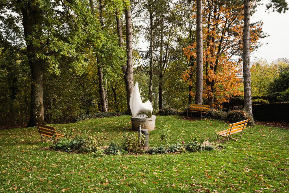
Discover the Limpertsberg district in Luxembourg City with its remarkable architecture, its church, and its landscaped parks.

You walk to the Glacis and then past the Grand Théâtre before reaching the "Red Bridge." You follow the Alzette valley and continue through the Millebaach valley to Tony-Neuman Park, from where you return to the starting point.

Suggestions nearby

Auto-Pédestre hiking trail Limpertsberg

  • ©LFT - Vanessa Migone
    Tony Neuman Park
    Tony Neuman Park in Luxembourg-Limpertsberg is home to a collection of sculptures, some of which have been created by well-known Luxembourg sculptors
    Find out more
  • ©Brasserie Siegfried Von Westeschgaart
    Brasserie Siegfried Von Westeschgaart
    Brasserie Siegfried Von Westeschgaart
    Find out more

Similar hiking tours

©Ville de Dudelange, Ville de Dudelange
Circular routes
Local hiking trail Dudelange - "Buerfousswee"
Distance: 0,64 km
Duration: 0:10 h
Difficulty: easy
Find out more
©Pancake!
Circular routes
Natura 2000 trail - Boucle A: « L’homme et la forêt » – 5 km
Distance: 5,51 km
Duration: 1:30 h
Difficulty: easy
Find out more
©KuFa
Circular routes
Natura 2000 Trail - Boucle C: "La succession végétale sur un ancien territoire minier" – 2,5 km
Distance: 2,68 km
Duration: 0:45 h
Difficulty: easy
Find out more
©ORT SUD
Circular routes
Local hiking trail Esch: Sentier Norbert Theis Trail – 7km
Distance: 7,98 km
Duration: 2:15 h
Difficulty: easy
Find out more
©Pulsa Pictures, ORT SUD
Circular routes
Local hiking trail Esch: Burgronn - 3 km
Distance: 2,97 km
Duration: 0:45 h
Difficulty: easy
Find out more
©Visit Luxembourg
Circular routes
Auto-Pédestre trail Tadler
Distance: 4,57 km
Duration: 1:30 h
Difficulty: easy
Find out more
©Visit Luxembourg
Circular routes
Auto-Pédestre trail Bürden
Distance: 4,62 km
Duration: 1:25 h
Difficulty: easy
Find out more
©Visit Luxembourg
Thematic paths
Naturentdeckungspfad Cactusbësch
Distance: 6,09 km
Duration: 1:50 h
Difficulty: easy
Find out more
©Phothoteque de la Ville de Luxembourg - Tony Krier, Unknown
Shoah Memorial Trail in Luxembourg City
Distance: 3,26 km
Duration: 1:54 h
Difficulty: easy
Find out more
outdooractive This website uses technology and content from the Outdooractive Platform.