Starting point

Scheidgen

Destination

Scheidgen

Distance
16,52 km
Highest point
356 Hm
Lowest point
209 Hm
Aggregated Ascent
276 Hm
Aggregated Descent
291 Hm
Visit Luxembourg

Description

Mullerthal Touring - Drive & Hike Tour Bei dieser Tour erkunden Sie tolle Felslandschaften und Höhlen!  

Scheidgen – Consdorf – Konsdrefer Millen – Müllerthal – Consdorf - Scheidgen

Start:  Scheidgen

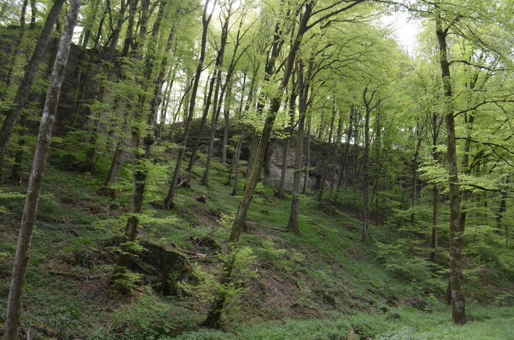
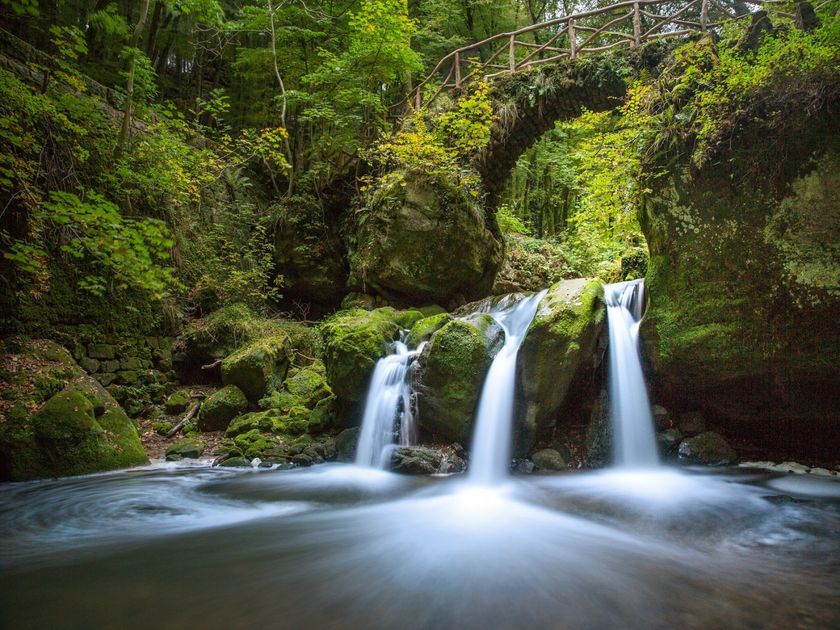
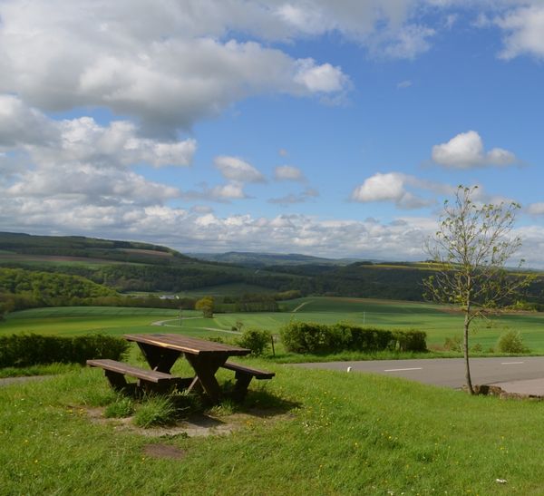
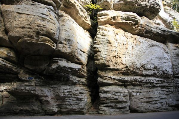
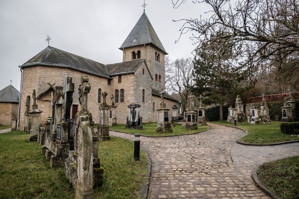
In Scheidgen das Auto neben der Kirche stehen lassen. Auf dem Wanderweg "Auto-Pédestre" (blau-weißes Dreieck) geht es zu den Felsformationen Dachselee und Härgottskapp. Sobald Sie den Wald verlassen, gehen Sie nach rechts zurück zum Parkplatz. Länge der Wanderung: 3 km; Gehzeit: 50 Minuten. Danach fahren Sie über Consdorf in Richtung Müllerthal. Am Parkplatz bei der Consdorfer Millen das Auto stehen lassen, die Straße überqueren und nach links in den Wald gehen. Auf dem Mullerthal Trail geht es zur Kuelscheier. Dort durchlaufen Sie sehr schmale, dunkle Felspassagen wie Rittergang und Déiwepëtz. Nichts für klaustrophobische Menschen; eine Taschenlampe ist ein Muss! Am Teich links geht es über den Waldweg zum Auto zurück. Länge der Wanderung: 3,5 km. Gehzeit: 75 Minuten. Die Fahrt führt weiter Richtung Müllerthal, wo man am Breidweiler-Pont rechts in Richtung Müllerthal abbiegt (Busse sollten nach Consdorfer Millen rechts Richtung Müllerthal fahren). Nach 300 m das Auto rechts auf dem Parkplatz stehen lassen und über den Waldweg bis zum Wasserfall Schiessentümpel laufen. Die Distanz zum Schiessentümpel und wieder zum Auto zurück beträgt 1 km. In der Ortschaft Müllerthal empfiehlt sich ein Stopp im Touristcenter Heringer Millen, wo man kostenlos Wanderequipment ausleihen kann. Danach geht es über Consdorf zurück nach Scheidgen.

Suggestions nearby

Drive & Hike Tour

  • ©Hotel Restaurant Le Cigalon
    Restaurant Le Cigalon
    Restaurant Le Cigalon
    Find out more
  • ©Heringer Mille
    Touristcenter „Heringer Millen"
    Touristcenter „Heringer Millen"
    Find out more
  • Schiessentümpel / Schéissendëmpel Wasserfall
    Schiessentümpel / Schéissendëmpel Wasserfall
    Find out more
  • ©SIT Consdorf
    Tourist Info Consdorf
    Tourist Info Consdorf
    Find out more
  • ©Restaurant Grill Bon Repos
    Restaurant Grill Bon Repos
    Restaurant Grill Bon Repos
    Find out more

Similar hikes

©Tom Barnich, Tom Barnich
Mullerthal Tour - Grand Tour du Luxembourg
Distance: 121,82 km
Duration: 1:55 h
Difficulty: mittel
Find out more
©Pancake!, Visit Luxembourg
Guttland WEST Tour – Grand Tour du Luxembourg
Distance: 140,64 km
Duration: 2:10 h
Difficulty: mittel
Find out more
©Pancake!, Visit Luxembourg
Guttland ZENTRUM Tour – Grand Tour du Luxembourg
Distance: 100,98 km
Duration: 1:35 h
Difficulty: leicht
Find out more
©PANCAKE! Photographie, ORT MPSL
Mullerthal Grand Tour
Distance: 74,07 km
Duration: 1:10 h
Find out more
©ORT MPSL, ORT MPSL
Large Geopark Tour
Distance: 79,70 km
Duration: 1:15 h
Find out more
©ORT MPSL, ORT MPSL
Small Geopark Tour
Distance: 39,02 km
Duration: 0:35 h
Find out more
©ORT MPSL
Panorama Tour
Distance: 33,11 km
Duration: 0:30 h
Find out more
©Visit Luxembourg
Grand Tour du Luxembourg
Distance: 465,13 km
Duration: 7:10 h
Difficulty: schwer
Find out more
©Visit Luxembourg
Éislek Tour - Grand Tour du Luxembourg
Distance: 255,96 km
Duration: 3:55 h
Difficulty: schwer
Find out more
outdooractive This website uses technology and content from the Outdooractive Platform.