Description
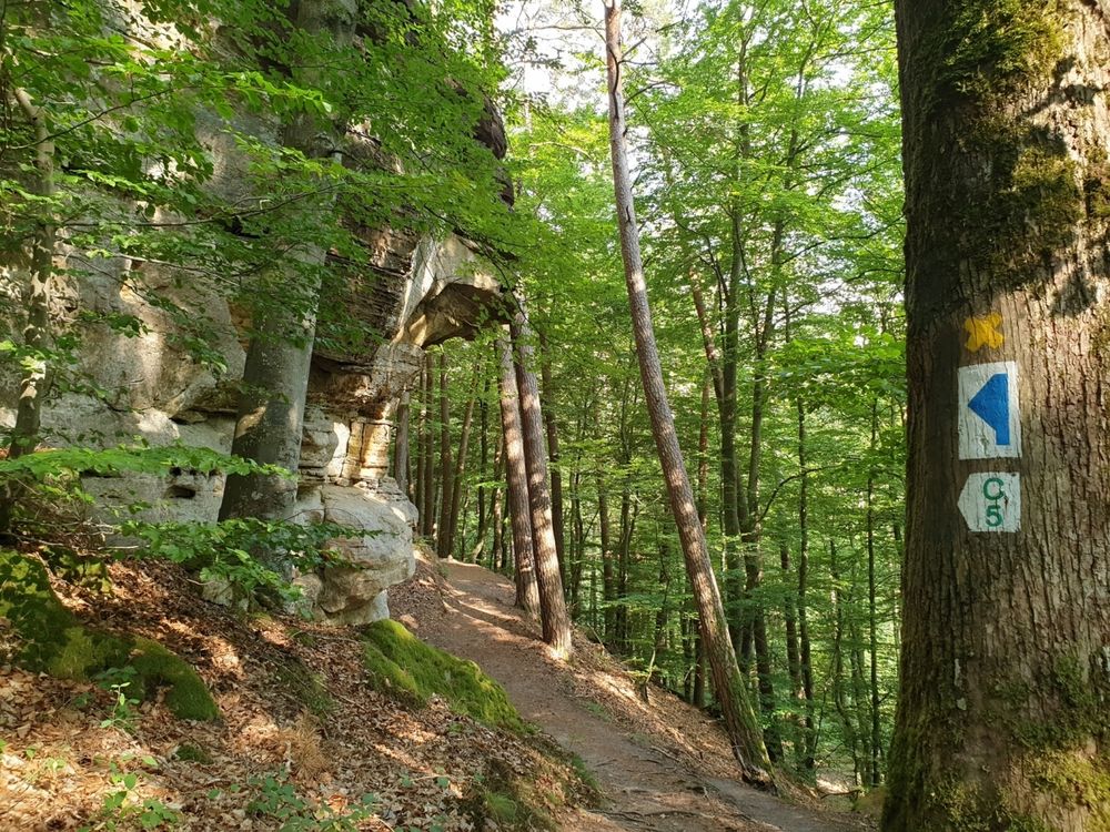
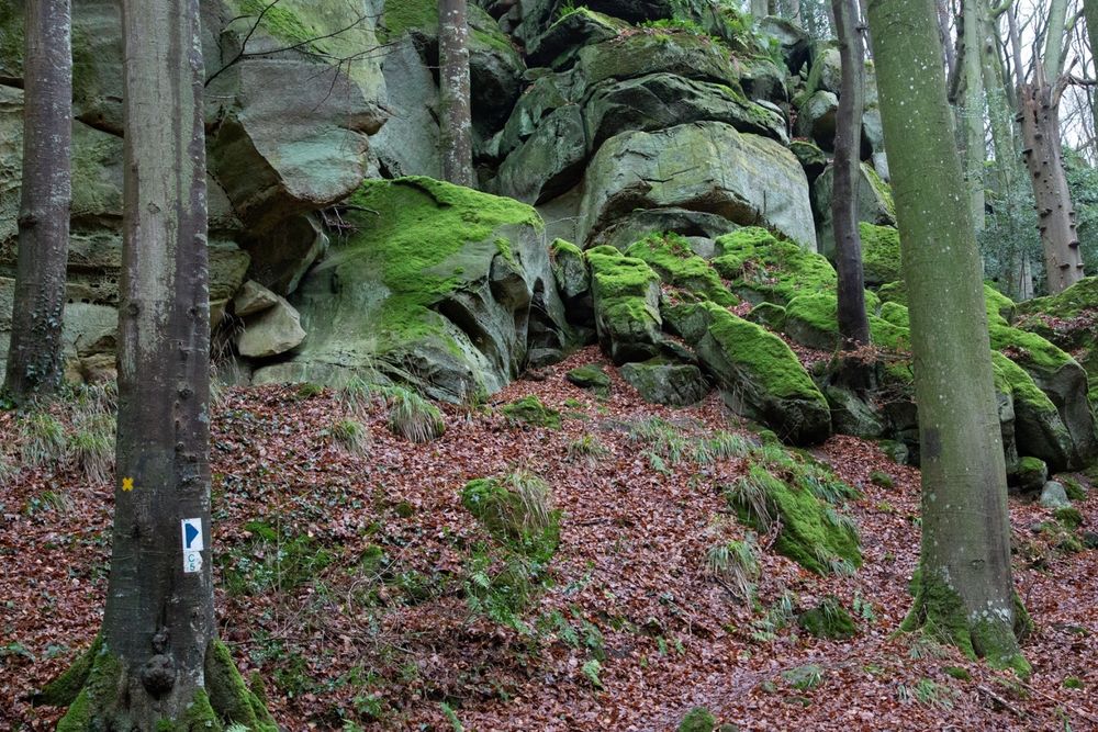
You will see one geological highlight after the other on this hike: mighty boulders such as the Päerdskapp (horse's head), peculiar forms of erosion and giant rock crevices such as the Schelmelee - a former dwelling. All of these very impressive with their astonishing variety and appearance. Due to narrow passages and rocky ground, the path is considered one of the more demanding hiking trails in Consdorf. You hike exclusively through the forest.
Directions
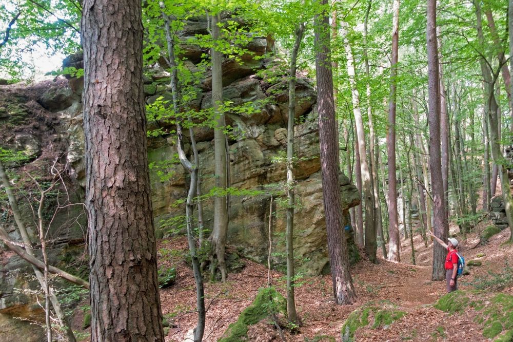
A wide forest path now leads into the valley of the brook Dosbaach, to the imposing Rammelee rock formation. On a short, somewhat strenuous detour up to the vantage point, you will witness a spectacular world of rocks.
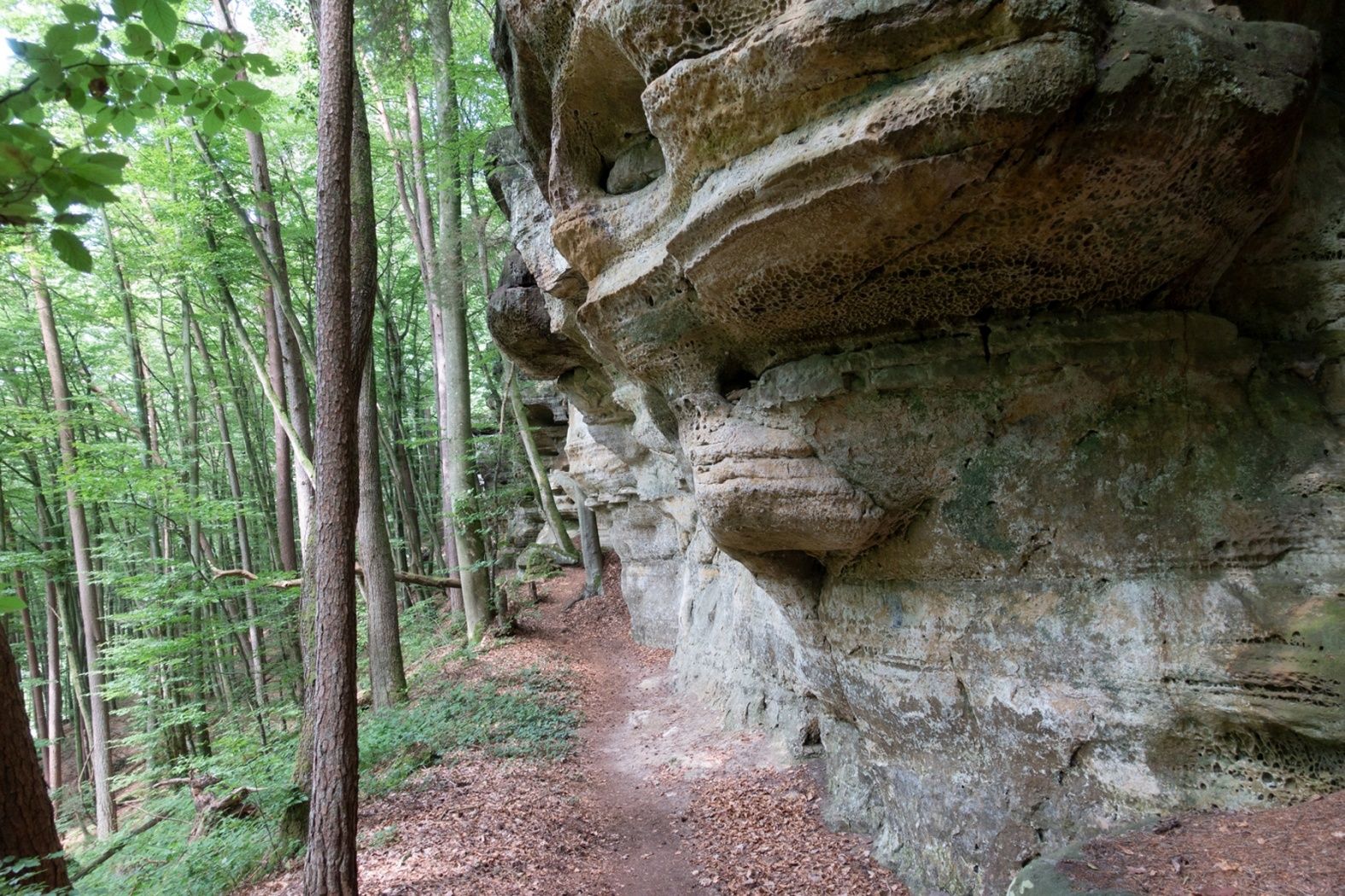
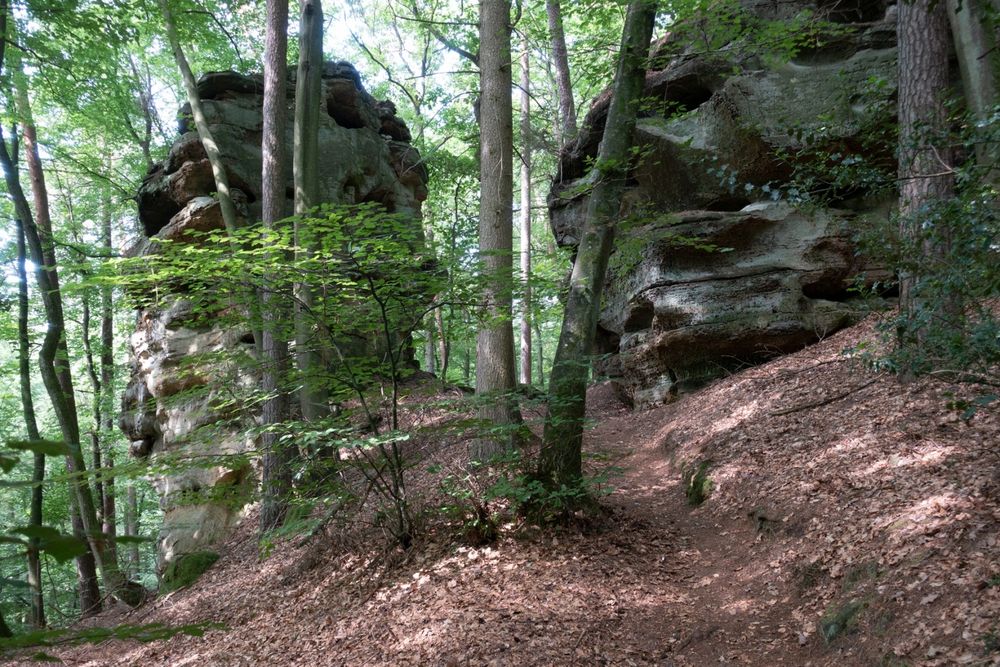
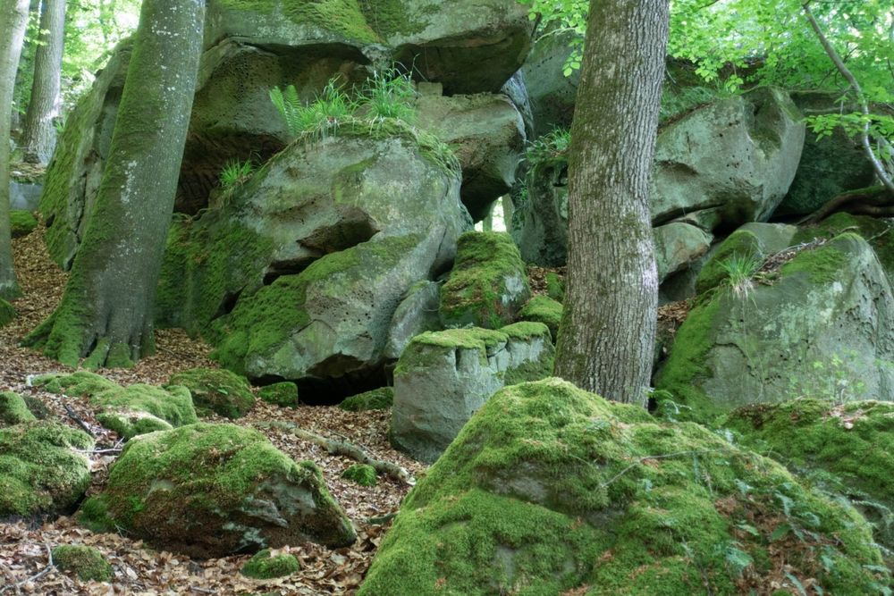
On the further course of the path, you will meander between countless boulders, which were created by millions of years of erosion. You pass a wildly rugged rock face with diverse weathering features and a lush flora such as the evergreen holly (ilex aquifolium).
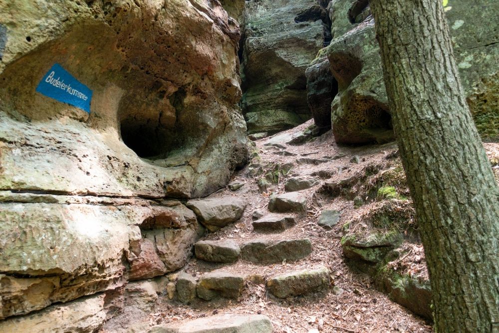
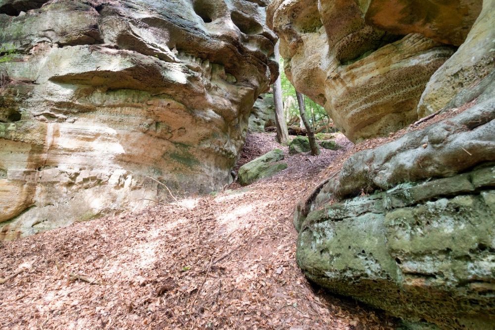
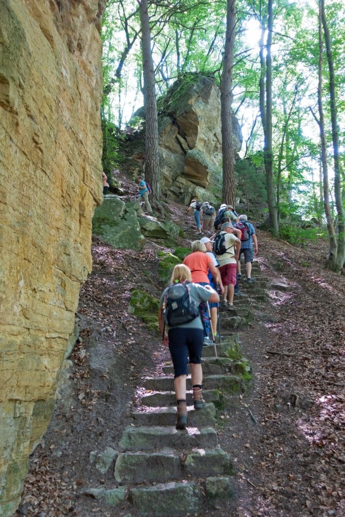
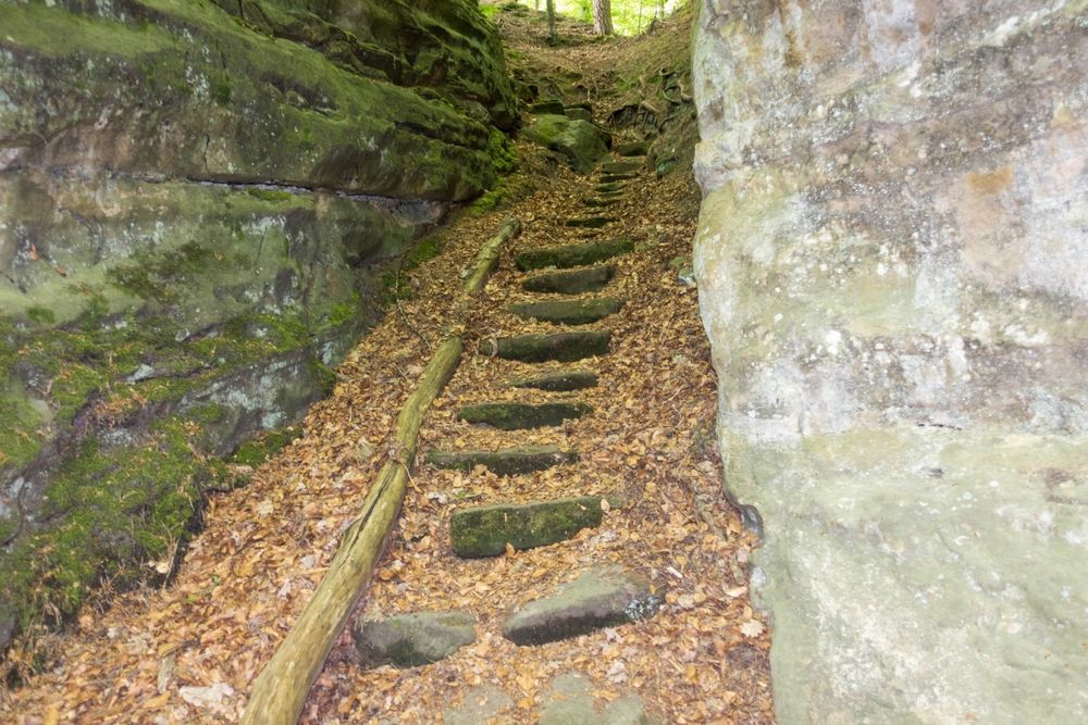
You soon reach the Schelmelee, one of those typical overhanging rocks that have been used as a dwelling since the Stone Age up to the recent past. You then cross the Alsbaach on a wooden bridge and reach the upper part of the hike. You cross a rock labyrinth full of stairs which lead to the narrow passage of Buddelerkummer. Mighty boulders such as the Päerdskapp (Horse's Head), curious forms of erosion and gaping crevices impress with their amazing variety and appearance.
After having reached the valley of the Biersbaach, you make your last ascent towards the steep rock faces of the Buergkapp, an important former fortified refuge. After crossing it through two narrow crevices, you reach your starting point in the valley.
Equipment
Journey
Parking: Closest parking lot: Konstrëfermillen (50 m)


 This website uses technology and content from the Outdooractive Platform.